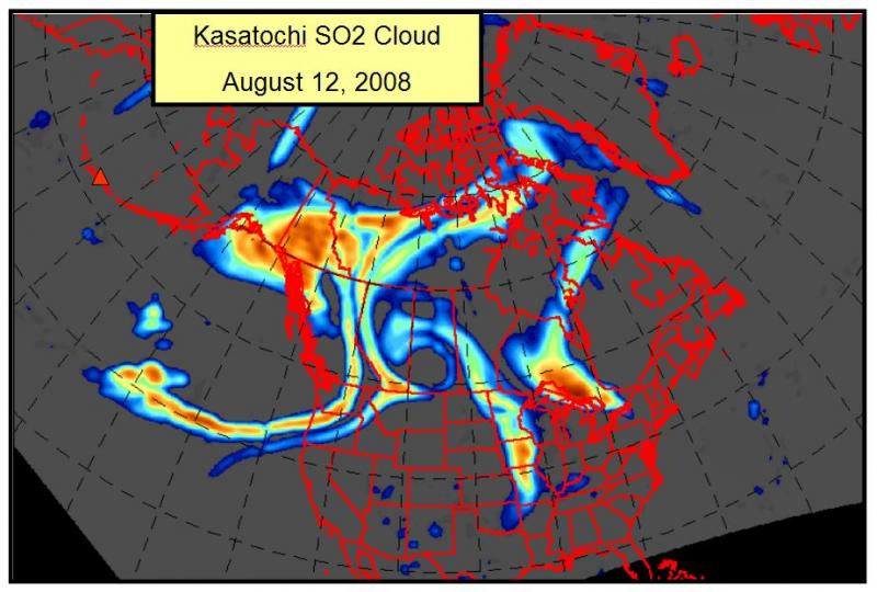
Composite satellite image from August 12 showing the sulfur dioxide cloud produced by the August 7 eruption of Kasatochi. This cloud circled the northern hemisphere between 35,000 to 45,000 feet above sea level. Colors represent relative amount of gas with dark orange being the highest and dark blue the lowest. These data are from NASA’s EOS-Aura satellite and its Ozone Monitoring Instrument (OMI), courtesy of Dr. Simon Carn, University of Maryland, Baltimore County.
Date: Aug 12th, 2008
Volcano(es): Kasatochi
Photographer: Schneider, D. J.
URL: avo.alaska.edu/image/view/15049
Image courtesy of AVO/USGS.Volcano(es): Kasatochi
Photographer: Schneider, D. J.
URL: avo.alaska.edu/image/view/15049
Please cite the photographer and the Alaska Volcano Observatory / U.S. Geological Survey when using this image. Data provided by the OMI near-real-time project funded by NASA.
Full Resolution.