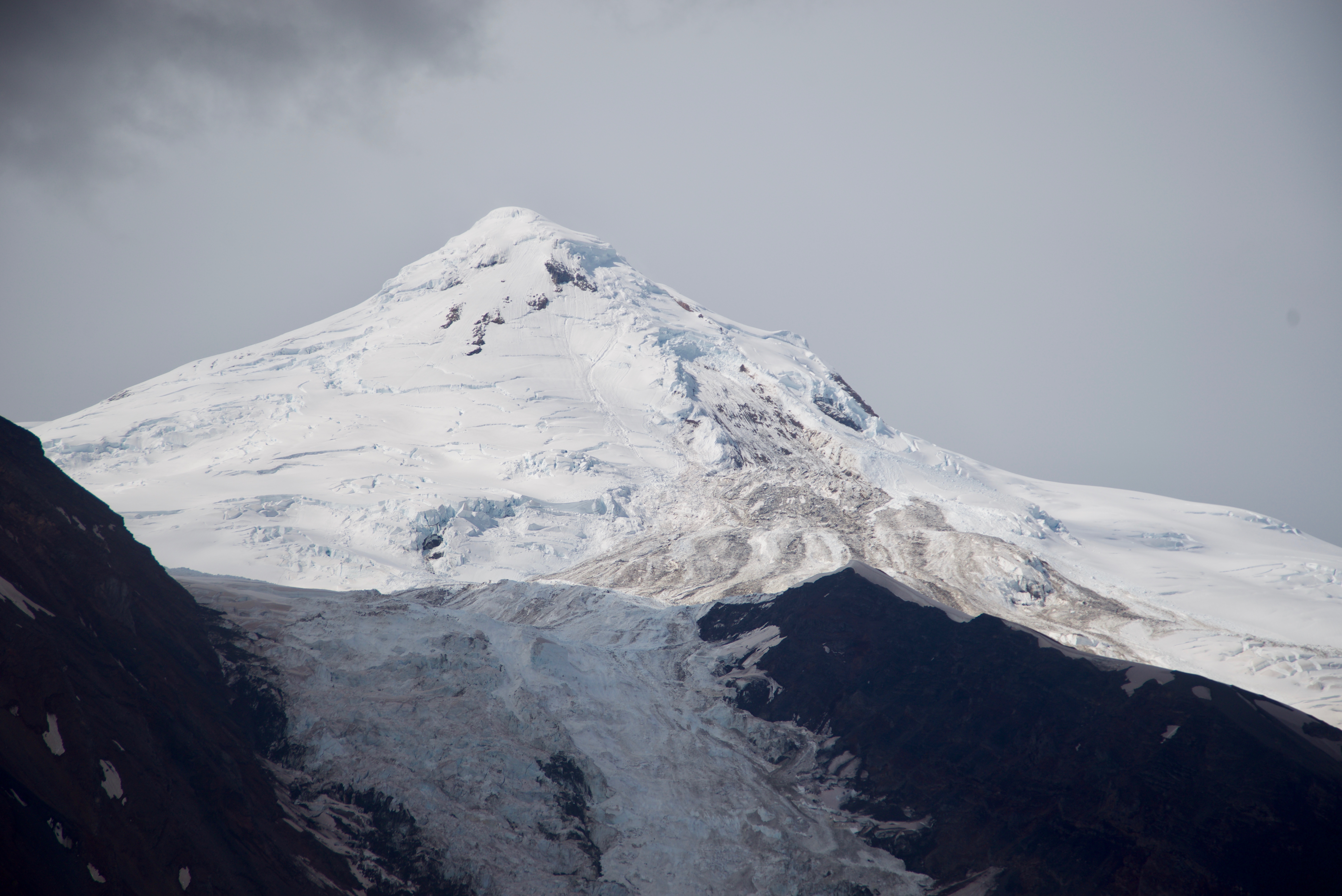
Ice and debris slide on Spurr Summit, 7/17/19 - 2 days after it was suspected to have occurred.
Volcano(es): Spurr
Photographer: Read, Cyrus
URL: avo.alaska.edu/image/view/153251
Spurr non-eruptive activity 2019
From Orr and others, 2023: "On July 15, 2019, at 16:32 UTC (08:32 AKDT), a large ice and rock avalanche took place on the southeast flank of Mount Spurr. A retrospective analysis of satellite imagery indicated the starting zone of the avalanche was less than 1 km from the summit of the volcano. Clear satellite images of the flow deposit showed that it widened before splitting into two lobes that flowed around an elevated lateral moraine dividing the west and east branches of K’idazq’eni Glacier (March and others, 1997; Molnia, 2008). One lobe flowed down the west branch between the moraine and the Crater Peak cone, while the other traveled slightly farther down the east branch of the glacier. Satellite imagery indicated the ice and rock avalanche spanned an area of approximately 2.3×10^6 square meters (m2) [25,000,000 square feet]. Assuming an average deposit thickness of 0.5 m [1.6 feet] yields a volume of about 1.2×10^6 cubic meters (m3) [42,000,000 cubic feet].
"The ice and rock avalanche generated energetic seismic and acoustic signals, recorded both locally and regionally. High-frequency signals were detected on the local seismic network and long-period (LP) seismic signals were recorded more than 700 km [435 mi] away. Several local seismic stations also recorded approximately 10 minutes of precursory seismicity. Pre-avalanche seismicity has been previously documented at Iliamna Volcano (Caplan-Auerbach and Huggel, 2007). In addition to the recordings of seismic signals, an infrasound array in Dillingham, Alaska, detected acoustic waves from the event.
"During an overflight on August 27, AVO staff noted the terrain of the source area consisted of exposed 'slope-parallel lava, with rivulets of meltwater running on its surface.' They found no evidence of increased non-meteorological heating at the summit area (a phenomenon which can trigger ice and rock avalanches) and observed nothing unusual on the other flanks of the summit cone (M. Coombs, USGS, written commun., 2019). The July 15 avalanche took place in an area known for debris flows, as documented by Coombs and others (2006), but previous flows were smaller and more water-rich than the July 15 event. Mount Spurr remained at an Aviation Color Code and Volcano Alert Level of GREEN and NORMAL throughout 2019."
Please cite the photographer and the Alaska Volcano Observatory / U.S. Geological Survey when using this image.
Full Resolution.