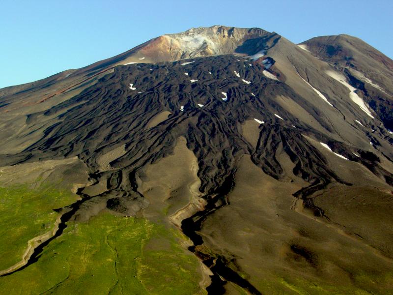
Gareloi Volcano, elevation 1573 m, in the western Aleutian Islands, Alaska. Levied lava flows from a 1980s eruption drape the south flank of the southern summit crater. The white zone on the crater headwall is an extensive fumarole field.
Volcano(es): Gareloi
Photographer: McGimsey, R. G.
URL: avo.alaska.edu/image/view/1992
Gareloi 1980/8
Coombs and others (2008) summarize the 1980 eruption: "On August 8, the crew of a Northwest Orient Airlines plane spotted a plume of ash that rose 35,000-40,000 ft above sea level (Anchorage Times, August 16, 1980, p. A3). David Evans of the USGS reported earthquakes whose epicenters were west of the Adak seismic network on August 8 and 9. Ash fall was not reported at Adak. Cloud cover mostly obscured further observations after August 10, although a photograph of the summit from August 13 shows a light-gray plume rising from the North Peak crater [see fig. 9 in original text]. Evans said, 'As far as we know, there was no lava eruption' (Anchorage Times, August 16, 1980, p. A3). On August 10, airborne stratospheric sampling detected ash and elevated sulfate concentrations between 54 degrees N and 60 degrees N and 150 degrees W (about 2,000 km away) at an altitude of 63,000 ft asl (Sedlacek and others, 1981). On the basis of wind direction and NOAA-6 satellite imagery, the plume was a plausible product of the August 8 eruption (Sedlacek and others, 1981). The Smithsonian reported renewed ash emissions to 6 km asl in September 1980."
Please cite the photographer and the Alaska Volcano Observatory/U.S. Geological Survey when using this image.
Full Resolution.