


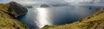
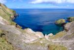
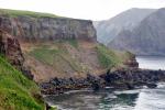
Davidof
Davidof Eruption Timeline
| Red (Warning) | |
| Orange (Watch) | |
| Yellow (Advisory) | |
| Green (Normal) | |
| Uninstrumented | |
| Community | |
| Webcam | |
| Instrument | |
| Earthquake Magnitude | |
|
0
| |
| Earthquake Age | |
| Last 2 Hours | |
| Last 2 Days | |
| Last 1 Week | |
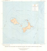
Distance from Anchorage: 1349 mi (2171 km)
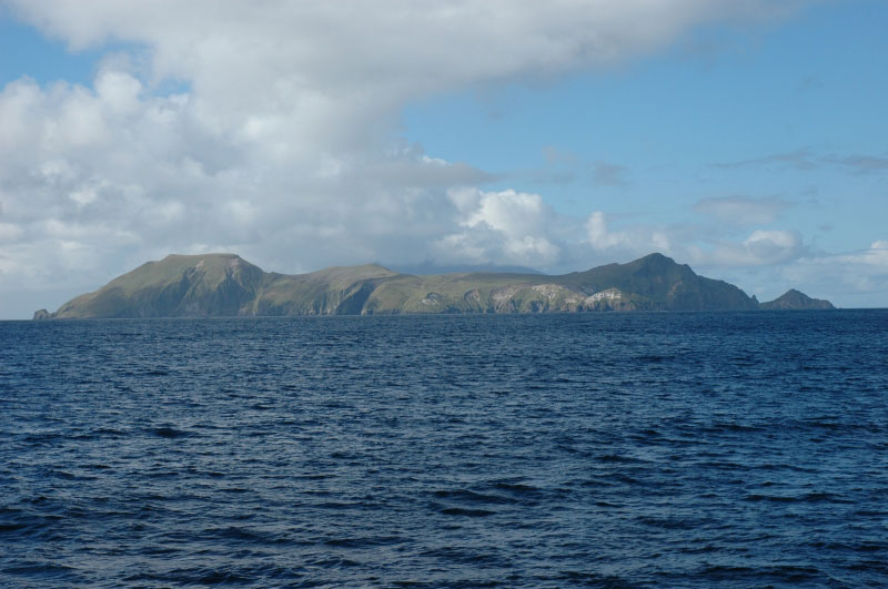
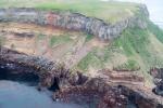
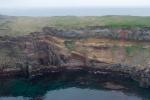
Davidof Island's name was published by Admiral von Krusenstern (1827), for the Russian naval officer Gavriil Ivanovich Davidov, who, with N.A. Khvostov, explored Alaska during 1802-1804. Admiral von Kruzenstern applied the name "I[sle] Dawydoff" to Segula Island, but in 1855 the U.S. Navy Hydrographic Office clarified the size and position of both Davidof and Segula Islands and reapplied the names (Orth, 1971).
Davidof Eruption Timeline
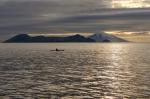
 at Davidof, Dec 10, 2021.")
From Orr and others, 2024: "On December 7, 2021, at 15:33 HAST (December 8 at 01:33 UTC), an earthquake swarm occurred 7.5 km north of Davidof volcano. During the first few days of the swarm, several energetic earthquake bursts took place, the largest of which was a ML 4.2 on December 10. The sudden increase in seismic activity was uncharacteristic of the area, prompting AVO to raise the Aviation Color Code and Volcano Alert Level from UNASSIGNED to YELLOW and ADVISORY on December 10 in anticipation of possible volcanic activity.
"Seismicity waned gradually over the next week and the swarm seemingly ceased on December 20. The hypocenters of earthquakes from the swarm formed a northeast-southwest trending lineation north of the volcano. However, this linear trend is interpreted to be an artifact because the earthquakes were located outside the regional network-the closest seismic stations are the four on Little Sitkin Island, ~12 km [~7 mi] east of Davidof volcano. The earthquakes occurred at a variety of depths, the deepest of which was 9.8 km [6.1 mi] below sea level. Notably, the swarm produced 2 earthquakes of ML >4 and 13 earthquakes of ML >3. On December 29, more than one week after the swarm ended, AVO lowered the Aviation Color Code and Volcano Alert Level of Davidof volcano to UNASSIGNED."
AVO raised Davidof to YELLOW/ADVISORY again on January 26, 2022, stating "over the past two days a swarm of earthquakes has occurred in the vicinity of Davidof volcano. The largest earthquake in the current sequence happened yesterday at 4:02 PM AKST (January 26, 01:02 UTC) and had a magnitude of 4.9. A similar earthquake swarm occurred in December 2021. No signs of unrest have been observed in recent satellite images of the volcano."
Elevated seismic activity continued for a few months, occasionally including earthquakes of ML = 3. Afterwards, seismicity gradually declined, and AVO lowered the alert levels to UNASSIGNED on April 22, 2022.
| Eruption | |
| Questionable eruption | |
| Non-eruptive activity |


Mathematical models developed by the USGS forecast various aspects of how a volcanic ash plume will interact with wind—where, how high, and how fast ash particles will be transported in the atmosphere, as well as where ash will fall out and accumulate on the ground. AVO runs these models when a volcano is restless by assuming a reasonable hypothetical eruption, to provide a pre-eruptive forecast of areas likely to be affected. During an ongoing eruption, AVO will update the forecast with actual observations (eruption start time and duration, plume height) as they become available.
The Ash3d model was developed by the USGS to forecast how a volcanic ash plume will interact with wind and where ash will fall out and accumulate on the ground. AVO runs these models twice daily when a volcano is restless by assuming a reasonable hypothetical eruption altitude and duration. The map shows the model results of ashfall thickness for areas that are likely to be affected, if one were to occur. During an ongoing eruption, AVO will update the forecast with actual observations (eruption start time and duration, plume height) as they become available, and these plots will be automatically updated. The National Weather Service Anchorage Forecast Office will issue the official ashfall warning product and post them at weather.gov/afc
THESE PRODUCTS MAY NOT BE CURRENT.During an actual eruption, see National Weather Service forecasts of ashfall:https://weather.gov/afc.
This map shows the modeled estimate of the time it would take for ashfall to begin following an eruption. It corresponds to the ashfall thickness forecast map shown above. This map uses the start time of either the twice-daily hypothetical model runs (time shown in the legend) or the actual eruption start time (if one were to occur). In the case of an actual eruption, the National Weather Service Anchorage Forecast Office will issue the official ashfall warning product that includes the ashfall start time and post them at weather.gov/afc
THESE PRODUCTS MAY NOT BE CURRENT.During an actual eruption, see National Weather Service forecasts of ashfall:https://weather.gov/afc.