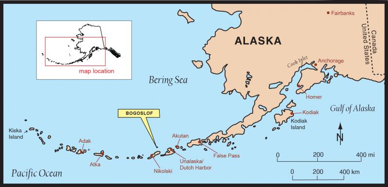
Index map showing the location of Bogoslof Volcano. Adapted from Beget, J.E., Larsen, J.F., Neal, C.A., Nye, C.J., and Schaefer, J.R., 2005, Preliminary volcano-hazard assessment for Okmok Volcano, Umnak Island, Alaska: Alaska Division of Geological & Geophysical Surveys Report of Investigation 2004-3, 32 p., 1 sheet, scale 1:150,000.
Date: Dec 20th, 2016
Volcano(es): Bogoslof
Photographer: Alaska Volcano Observatory
URL: avo.alaska.edu/image/view/103411
Credit: Image courtesy of the AVO/ADGGS.
Use Restriction: Please cite the photographer and the Alaska Volcano Observatory / Alaska Division of Geological & Geophysical Surveys when using this image.
Full Resolution.