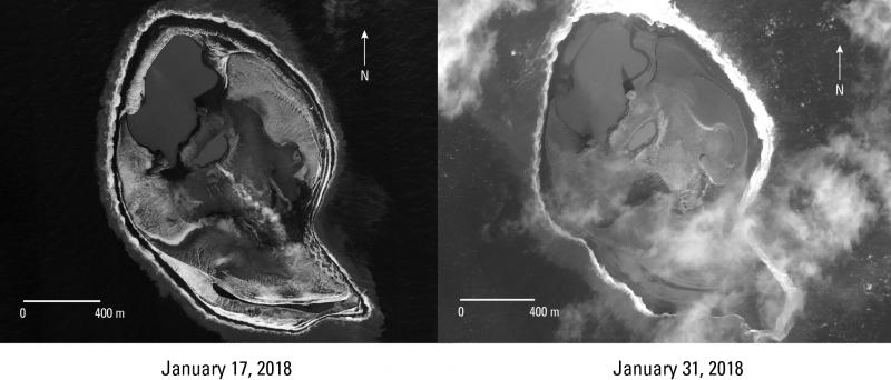
Worldview-2 satellite images of Bogoslof Island from January 17 and January 31, 2018. The steam emission evident in the January 17 image has been persistent since late August, but appears to be declining in these images. Wave erosion is beginning to remove material emplaced during the 2016-17 eruption, particularly evident on the southwest side of the island. The island area in both images is about 1.6 square km. Image data acquired with the Digital Globe NextView License.
Image courtesy of AVO/USGS.Please cite the photographer and the Alaska Volcano Observatory / U.S. Geological Survey when using this image.
Full Resolution.