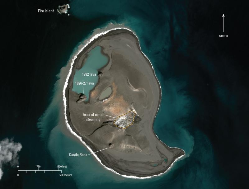
April 20, 2018 WorldView-3 image of Bogoslof Island. The land area of the island is about 1.4 square km and is about the same as observed in a previous image from late February, 2018. The area of minor steaming is slightly smaller and is consistent with the decline in unrest and cooling of the deposits emplaced during the 2016-17 eruptive period. Satellite data obtained with Digital Globe NextView License.
Date: Apr 20th, 2018
Volcano(es): Bogoslof
Photographer: Waythomas, Chris
URL: avo.alaska.edu/image/view/116891
Image courtesy of AVO/USGS.Volcano(es): Bogoslof
Photographer: Waythomas, Chris
URL: avo.alaska.edu/image/view/116891
Please cite the photographer and the Alaska Volcano Observatory / U.S. Geological Survey when using this image.
Full Resolution.