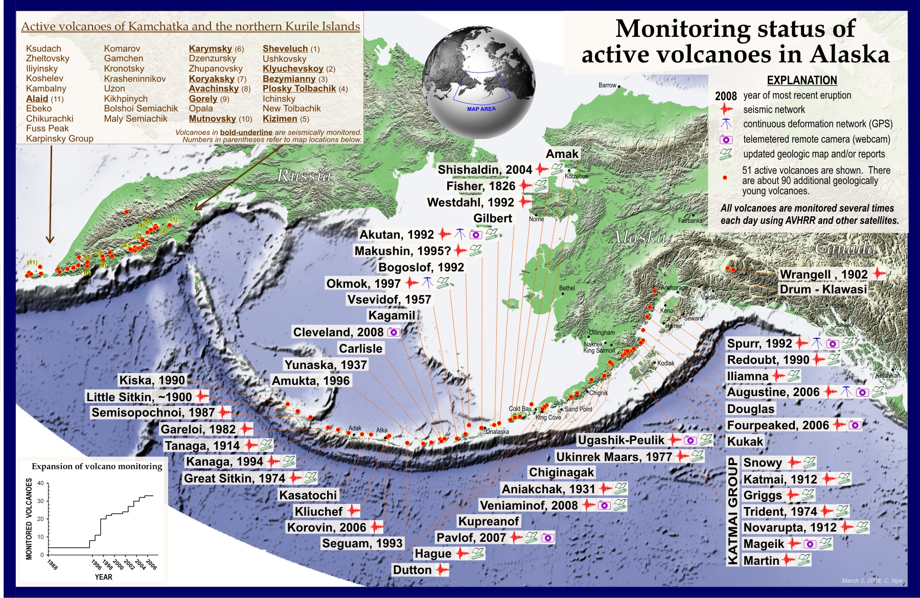
Map showing monitoring status of Alaska volcanoes (current as of spring 2008). This map is published in: Schaefer, J.R., and Nye, Chris, 2008, The Alaska Volcano Observatory - 20 years of volcano research, monitoring, and eruption response: Alaska Division of Geological & Geophysical Surveys, Alaska GeoSurvey News, NL 2008-001, v. 11, n. 1, p. 1-9, available at http://wwwdggs.dnr.state.ak.us/pubs/pubs?reqtype=citation&ID=16061 .
Date: Mar 4th, 2008
Volcano(es): Akutan Aniakchak Atka volcanic complex Augustine Bogoslof Carlisle Chiginagak Cleveland Dana Douglas Dutton Emmons Lake Volcanic Center
Photographer: Nye, C. J.
URL: avo.alaska.edu/image/view/14033
Credit: Map courtesy of the Alaska Volcano Observatory.
Use Restriction: Please cite AVO as the source.
Full Resolution.
×
![Instrument data]()