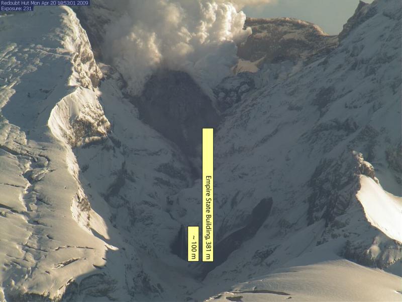
Annotated webcam image from April 20, 2009, showing approximate height of the waterfall, and a corresponding bar for how high the Empire State Building would look next to the waterfall. These measurements are approximate, subject to revision, and are only intended as a sense of scale - it is not possible to accurately measure the height of the dome from these webcam images. The April 20, 2009, debris flow is visible just to the right of the yellow bars. AVO gives special thanks to Marc Linsey, for his help in the creation of this figure.
Volcano(es): Redoubt
Photographer: Alaska Volcano Observatory
URL: avo.alaska.edu/image/view/18224
Credit: Image courtesy of AVO/USGS.
Use Restriction: Please cite the photographer and the Alaska Volcano Observatory / U.S. Geological Survey when using this image.
Full Resolution.
Redoubt 2009/3
From Schaefer (ed), 2012: "Redoubt Volcano, an ice-covered stratovolcano on the west side of Cook Inlet, erupted in March 2009 after several months of escalating unrest. The 2009 eruption of Redoubt Volcano shares many similarities with eruptions documented most recently at Redoubt in 1966-68 and 1989-90. In each case, the eruptive phase lasted several months, consisted of multiple ash-producing explosions, produced andesitic lava and tephra, removed significant amounts of ice from the summit crater and Drift glacier, generated lahars that inundated the Drift River valley, and culminated with the extrusion of a lava dome in the summit crater. Prior to the 2009 explosive phase of the eruption, precursory seismicity lasted approximately six months with the first weak tremor recorded on September 23, 2008. The first phreatic explosion was recorded on March 15, and the first magmatic explosion occurred seven days later, at 22:34 on March 22. The onset of magmatic explosions was preceded by a strong, shallow swarm of repetitive earthquakes that began about 04:00 on March 20, 2009, less than three days before an explosion. Nineteen major ash-producing explosions generated ash clouds that reached heights between 17,000 ft and 62,000 ft (5.2 and 18.9 km) ASL. During ash fall in Anchorage, the Ted Stevens International Airport was shut down for 20 hours, from ~17:00 on March 28 until 13:00 on March 29. On March 23 and April 4, lahars with flow depths to 10 m in the upper Drift River valley inundated parts of the Drift River Terminal (DRT). The explosive phase ended on April 4 with a dome collapse at 05:58. The April 4 ash cloud reached 50,000 ft (15.2 km) and moved swiftly to the southeast, depositing up to 2 mm of ash fall in Homer, Anchor Point, and Seldovia. At least two and possibly three lava domes grew and were destroyed by explosions prior to the final lava dome extrusion that began after the April 4 event. The final lava dome ceased growth by July 1, 2009, with an estimated volume of 72 Mm3."
Wallace and others (2012) calcuate a total Dense Rock Equivalent of about 0.02 cubic meters for tephra fall from the Redoubt 2009 eruption.