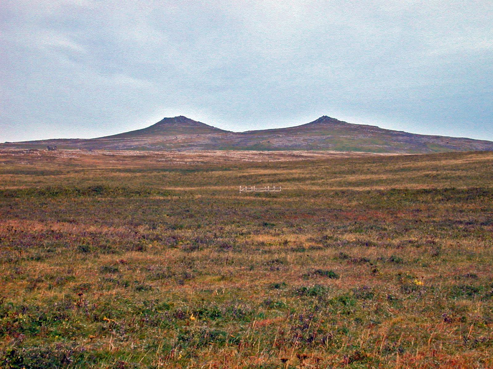
Bogoslof Hill, located at the center of St. Paul Island, is a low-profile shield with a double summit composed of two cone-shaped vents. The gently sloping lower flanks (<8deg) of the volcano steepen abruptly to 30deg at the summit cones, which are formed almost entirely of welded spatter with minor amounts of scoria. The northwestern cone (on the left) is a truncated rim of spatter and layered agglutinate surrounding a shallow crater. A lava lake, now solidified, ponded in the crater and partially drained through a breach in the northeastern side of the rim. In the saddle between the cone-shaped vents is a ~30-m-wide crater surrounded by a low spatter rampart. The summit region of Bogoslof Hill is elongate east to west and is traversed by numerous subparallel east-west and northeast-southwest striking fissures. The most aerially extensive of all recent lava flows erupted on St. Paul Island extends radially from the Bogoslof Hill vent region and covers approximately 16 km2.
Volcano(es): St. Paul Island
Photographer: Feeley, T. C.
URL: avo.alaska.edu/image/view/1911
Credit: Image courtesy of the photographer.
Use Restriction: Please cite the photographer when using this image.
Full Resolution.