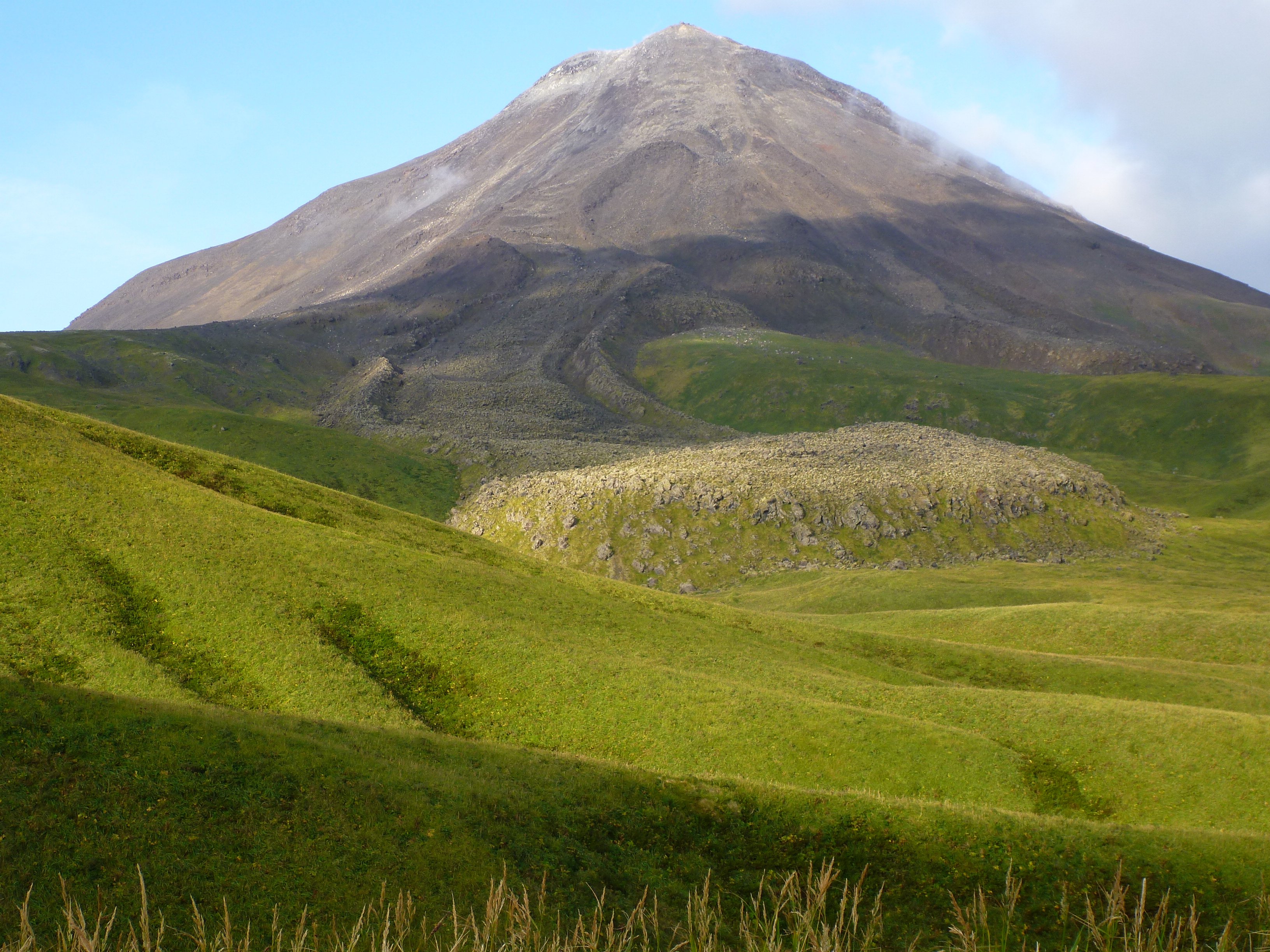
Kanaga Volcano, seen from the east, with blocky 1906 lava flow. 2015 Western Aleutians AVO-USGS, NSF Geoprisms and Deep Carbon Observatory field work.
Volcano(es): Kanaga
Photographer: Coombs, Michelle
URL: avo.alaska.edu/image/view/82801
Location:
Latitude: 51.916666666667
Longitude: -177.11786388889
Use Restriction: Please cite the photographer and the Alaska Volcano Observatory / U.S. Geological Survey when using this image.
Full Resolution.
Kanaga 1906/5
From Miller and others (1998): "A trapper living on the island in 1906 experienced several earthquakes and witnessed lava pouring down both east and west sides of the cone. Coats (1956) interpreted these flows to be the ones now present on the northeast and southwest slopes of Kanaga Volcano."
Coats (1956): "An eruption in May 1906 was reported in a letter to the writer from Simeon Oliver, teacher at Atka, who obtained his information from William Dirks of Atka. According to Dirks, who was trapping near Kanaga Volcano at the time, earthquakes occurred and lava poured down the east and west sides of the cone to the sea. It is possible that these lava flows are the ones now present on the southwest and northeast sides of the cone; however, only one of them reached the sea."