Aleutians

(52.0765, -176.1109)
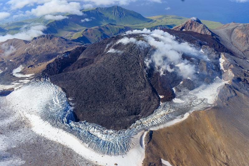
2026-05-11 20:24:22 UTC

Slow lava effusion continues within the Great Sitkin summit crater. Over the past day, seismic data recorded rockfalls from the growing lava dome. Minor lava flow growth to the east was observed in satellite radar imagery. Clouds otherwise obscured satellite and webcam views of the volcano.

The current lava eruption began in July 2021 and, since then, has filled most of the summit crater and advanced into valleys below. There have been no explosions at Great Sitkin Volcano since an event in May 2021. The volcano is monitored using local seismic and infrasound sensors, satellite data, webcams, and regional infrasound and lightning networks.

5709 ft (1740m) elevation
Instrumented

Aleutians

(54.7554, -163.9711)
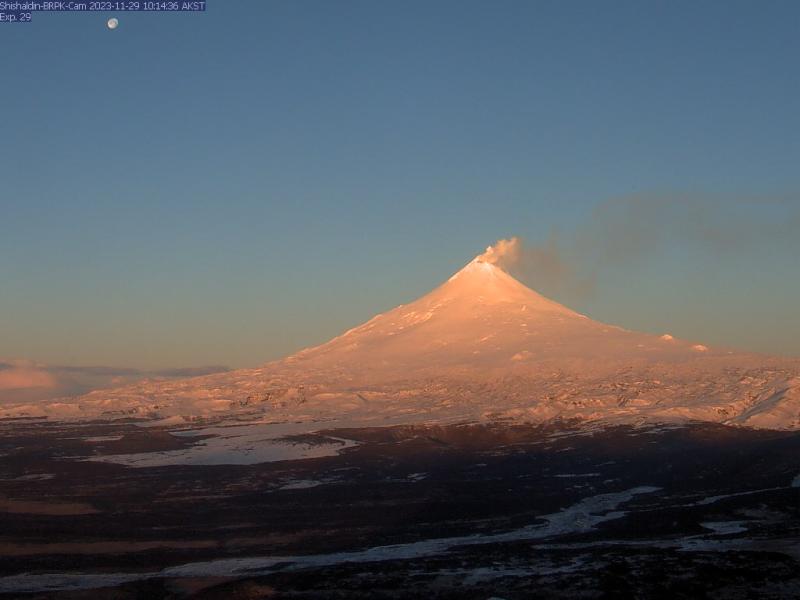
2026-05-11 20:24:22 UTC

Unrest persists at Shishaldin Volcano, with seismic and infrasound activity remaining elevated over the past day. Sulfur dioxide and steam emissions were observed in clear satellite imagery.

Local seismic and infrasound sensors, web cameras, and a geodetic network are used to monitor Shishaldin Volcano. In addition to the local monitoring network, AVO uses nearby geophysical networks, regional infrasound and lightning data, and satellite images to detect eruptions. 

9373 ft (2857m) elevation
Instrumented

Alaska Peninsula

(56.0126, -159.7912)
2026-05-12 17:01:17 UTC

Seismic activity and volcanic gas emissions increased over the past few months and now continue at elevated levels at Mount Kupreanof. This activity is likely caused by a magmatic intrusion beneath the volcano. The Alaska Volcano Observatory (AVO) is therefore increasing the Aviation Color Code to YELLOW and the Volcano Alert Level to ADVISORY in response to this sustained volcanic unrest. 


Summary of activity and hazards 

  • Seismicity was first detected in February 2026 and has increased in recent months, with earthquakes as large as magnitude 3.1 detected. 
  • Sulfur dioxide (SO2) emissions were detected beginning on April 4 with emission rates of ~100 to 1,000 tons per day, which are well above the background rate of <100 tons per day. 
  • These signals likely indicate a magmatic intrusion beneath Mount Kupreanof. 
  • AVO is therefore increasing the Aviation Color Code to YELLOW and the Volcano Alert Level to ADVISORY in response to this sustained volcanic unrest. 
  • Data do not suggest an eruption is imminent and further signs of increased unrest would be expected prior to eruption. 
  • There is no local monitoring network at Mount Kupreanof. Seismicity is detected using only regional stations, which limits detection of smaller events (magnitudes <2) and results in large location errors. 


For more information: 

6217 ft (1895m) elevation
Instrumented


The Alaska Volcano Observatory (AVO) is a consortium of the U.S. Geological Survey, the University of Alaska Fairbanks Geophysical Institute, and the State of Alaska Division of Geological & Geophysical Surveys.
× Instrument data