Jarvis
Legend
✕
| Red (Warning) | |
| Orange (Watch) | |
| Yellow (Advisory) | |
| Green (Normal) | |
| Uninstrumented | |
| Community | |
| Webcam | |
| Instrument | |
| Earthquake Magnitude | |
|
0
| |
| Earthquake Age | |
| Last 2 Hours | |
| Last 2 Days | |
| Last 1 Week | |
Facts
- Official Name: Mount Jarvis
- Seismically Monitored: No
- Color Code: UNASSIGNED
- Alert Level: UNASSIGNED
- Elevation: 4091m (13421ft)
- Latitude: 62.0233
- Longitude: -143.6201
- Smithsonian VNum:
- Pronunciation:
-
Nearby Towns:
- Chitina 44 mi (71 km) SW
- McCarthy 47 mi (75 km) SE
- Kenny Lake 47 mi (75 km) SW
- Slana 48 mi (78 km) NW
- Chistochina 50 mi (81 km) NW
Distance from Anchorage: 214 mi (344 km)
Description
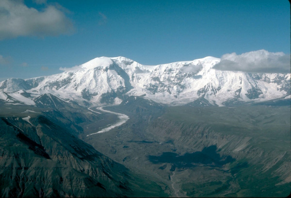
From Miller and Richter (1994) [1] : "This mountain is the high point of a slightly curvilinear, north-trending, 10-km-long, 4,000-m-high ridge. The snow- and ice-covered ridge is composed of a thick sequence of dacitic and andesitic lava flows and capped by either a massive dacite flow or by a series of smaller dacite domes. One K-Ar age on basal (?) Jarvis flows suggests an age of about 1.6 M [2] ."Name Origin
Mount Jarvis was named in 1903 by F.C. Schrader, for Captain D.H. Jarvis, who spent several years in Alaska (Orth, 1971).
References Cited
[1] Quaternary volcanism in the Alaska Peninsula and Wrangell Mountains, Alaska, 1994
Miller, T. P., and Richter, D. H., 1994, Quaternary volcanism in the Alaska Peninsula and Wrangell Mountains, Alaska: in Plafker, George, Jones, D. L., and Berg, H. C., (eds.), The Geology of Alaska, Geological Society of America The Geology of North America series v. G-1, p. 759-779.[2] Geologic map of the Nabesna A-5 quadrangle, Alaska, 1976
Richter, D.H., and Smith, R.L., 1976, Geologic map of the Nabesna A-5 quadrangle, Alaska: US Geological Survey Geologic Quadrangle Map 1292, 1 sheet, available at http://www.dggs.dnr.state.ak.us/pubs/pubs?reqtype=citation&ID=13027 .Loading Past Activity...
Loading Images...
Loading Maps...
Loading Bibliography...
Before an eruption
Ashfall & Preparedness Information
- Ashfall impacts & preparedness (US Geological Survey)
- Volcanic health hazards & impacts (International Volcanic Health Hazards Network)
- Ash Alert! Pamphlet (AK Division of Homeland Security & Emergency Management)
- Volcanic Ashfall (AK Department of Environmental Conservation, Division of Air Quality)