References
Song, Z., and Tan, Y.J., 2025, Characteristics of deep long-period earthquakes at Alaska volcanoes from 2005 to 2017: Journal of Geophysical Research - Solid Earth v. 130, no. 6., e2024JB030444. https://doi.org/10.1029/2024JB030444
Orr, T., Cameron, C.E., Dietterich, H.R., Loewen, M.W., Lopez, T., Lyons, J.J., Nakai, J., Power, J.A., Searcy, C., Tepp, G., and Waythomas, C.W., 2024, 2020 Volcanic activity in Alaska - Summary of events and response of the Alaska Volcano Observatory: U.S. Geological Survey Scientific Investigations Report 2024-5004, 34 p. https://doi.org/10.3133/sir20245004.
Orr, T.R., Dietterich, H.R., Fee D., Girona, T., Grapenthin, R., Haney, M.M., Loewen, M.W., Lyons, J.J., Power, J.A., Schwaiger, H.F., Schneider, D.J., Tan, D., Toney, L., Wasser, V.K., and Waythomas, C.F., 2024, 2021 Volcanic activity in Alaska and the Commonwealth of the Northern Mariana Islands - Summary of events and response of the Alaska Volcano Observatory: U.S. Geological Survey Scientific Investigations Report 2024-5014, 64 p. https://doi.org/10.3133/sir20245014.
Mallalieu, J., Barr, I.D., Spagnolo, M., Mullan, D.J., Symeonakis, E., Edwards, B.R., and Martin, M.D., 2024, Proximity to active volcanoes enhances glacier velocity: Communications Earth & Environment v. 5, 679. https://doi.org/10.1038/s43247-024-01826-5
Lubbers, J., Loewen, M.W., Wallace, Kristi, and Coombs, M.L., 2024, Source compositions of large tephra-production eruptions in Alaska: Alaska Division of Geological & Geophysical Surveys Raw Data File 2023-26, 3 p. https://doi.org/10.14509/31091
Pesicek, J.D., and Ryberg, T., 2024, Reference 1D seismic velocity models for volcano monitoring and imaging: Methods, models, and applications: Seismological Research Letters v. 95, no. 5, p. 2722-2744. https://doi.org/10.1785/0220240070
Ruppert, N.A., Farrell, A., Grassi, B., Holtkamp, S.G., Low, G., McFarlin, H., Nadin, E., Parcheta, C., West, M.E., and Wiser, S., 2024, Alaska Earthquake Center Quarterly Technical Report, October-December 2023: Alaska Earthquake Center Quaterly Technical Report 2023-Q4,49 p.
Cameron, C.E., Bull, K.F., and Macpherson, A.E., 2023, Recently active volcanoes of Alaska: Alaska Division of Geological & Geophysical Surveys Miscellaneous Publication 133 v. 6, 2 sheets. https://doi.org/10.14509/31086.
Lubbers, J., Loewen, M., Wallace, K., Coombs, M., and Addison, J., 2023, Probabilistic source classification of large tephra producing eruptions using supervised machine learning - an example from the Alaska-Aleutian Arc: Geochemistry, Geophysics, Geosystems v. 24, no. 11, e2023GC011037. https://doi.org/10.1029/2023GC011037.
Koulakov, I., Izbekov, P., Eichelberger, J., Al Arifi, N., and Qaysi, S.I., 2023, Interconnection of magma sources beneath the Katmai volcanic system inferred from seismic tomography and petrology: Journal of Volcanology and Geothermal Research v. 434, 107744. https://doi.org/10.1016/j.jvolgeores.2023.107744.
Bartz, K.K., Hannam, M.P., Wilson, T.L., Lepak, R.F., Ogorek, J.M., Young, D.B., Eagles-Smith, C.A., and Krabbenhoft, D.P., 2023, Understanding drivers of mercury in lake trout (Salvelinus namaycush), a top-predator fish in southwest Alaska's parklands: Environmental Pollution v. 330, 121678. https://doi.org/10.1016/j.envpol.2023.121678
Ruppert, N.A., Farrell, A., Grassi, B., Holtkamp, S.G., Low, G., McFarlin, H., Nadin, E., Parcheta, C., West, M.E., and Wiser, S., 2023, Alaska Earthquake Center Quarterly Technical Report, July–September 2023: Alaska Earthquake Center Quarterly Technical Report 2023-Q3, 52 p.
Alaska Volcano Observatory, National Oceanic and Atmospheric Administration, National Weather Service, Federal Aviation Administration, Department of Defense, United States Coast Guard, Division of Homeland Security and Emergency Management, Alaska Department of Environmental Conservation, and Alaska Department of Health and Social Services (participating agencies), 2022, Alaska interagency operating plan for volcanic ash episodes, 85 p.
Waythomas, C.F., 2022, Selected crater and small caldera lakes in Alaska: Characteristics and hazards: Frontiers in Earth Science, v. 9, p. 23, doi:10.3389/feart.2021.751216.
Davies, L.J., Jensen, B.L., and Kaufman, D.S., 2022, Late Holocene cryptotephra and a provisional 15,000-year Bayesian age model for Cascade Lake, Alaska: Geochronology, v. 4, p. 121-141, doi:10.5194/gchron-4-121-2022.
Cameron, C.E., Crass, S.W., and AVO Staff, eds, 2022, Geologic database of information on volcanoes in Alaska (GeoDIVA): Alaska Division of Geologic and Geophysical Surveys Digital Data Series 20, https://doi.org/10.14509/geodiva, https://doi.org/10.14509/30901.
Bai, Tong, Nayak, Avinash, Thurber, Clifford, Zeng, Xiangfang, and Haney, Mathew, 2021, Ambient noise tomography of the Katmai volcanic area, Alaska: Journal of Volcanology and Geothermal Research, v. 419, article no. 107373, 10 p., doi:10.1016/j.jvolgeores.2021.107373.
Power, J.A., Haney, M.M., Botnick, S.M., Dixon, J.P., Fee, David, Kaufman, A.M., Ketner, D.M., Lyons, J.J., Parker, Tom, Paskievitch, J.F., Read, C.W., Searcy, Cheryl, Stihler, S.D., Tepp, Gabrielle, and Wech, A.G., 2020, Goals and development of the Alaska Volcano Observatory seismic network and application to forecasting and detecting volcanic eruptions: Seismological Research Letters, doi: 10.1785/0220190216 .
Cameron, C.E., Schaefer, J.R., and Ekberg, P.G., 2020, Historically active volcanoes of Alaska: Alaska Division of Geological & Geophysical Surveys Miscellaneous Publication 133 v. 4, 2 sheets. Http://doi.org/10.14509/30426
Woods, T.W., Genareau, K., and Wallace, K.L., 2020, Influence of grain size and shape on volcanic ash electrical conductivity: Journal of Volcanology and Geothermal Research, v. 393, no. 106788, 9 p., doi: 10.1016/j.jvolgeores.2020.106788.
Dixon, J.P., Stihler S.D., Haney, M.M., Lyons, J.J., Ketner, D.M., Mulliken, K.M., Parker, T., and Power, J.A., 2019, Catalog of earthquake parameters and description of seismograph and infrasound stations at Alaskan volcanoes - January 1, 2013, through December 31, 2017: U.S. Geological Survey Data Series 1115, 92 p., https://doi.org/10.3133/ds1115.
Wallace, K.L., and Schwaiger, H.F., 2019, Volcanic ash resuspension from the Katmai region: Alaska Park Science, v. 18, n. 1., p. 63-70.
Power, J.A., Friberg, P.A., Haney, M.M., Parker, T., Stihler, S.D., and Dixon, J.P., 2019, A unified catalog of earthquake hypocenters and magnitudes at volcanoes in Alaska—1989 to 2018: U.S. Geological Survey Scientific Investigations Report 2019–5037, 17 p., https://doi.org/10.3133/sir20195037.
Mulliken, K.M., Schaefer, J.R., and Cameron, C.E., 2018, Geospatial distribution of tephra fall in Alaska: a geodatabase compilation of published tephra fall occurrences from the Pleistocene to the present: Alaska Division of Geological & Geophysical Surveys Miscellaneous Publication 164, 46 p. http://doi.org/10.14509/29847
Prejean, S.G., and Hill, D.P., 2018, The influence of tectonic environment on dynamic earthquake triggering: a review and case study on Alaskan volcanoes: Tectonophysics, v. 745, p. 293-304, doi.org/10.1016/j.tecto.2018.08.007.
Worden, A.K., Schaefer, J.R., and Mulliken, K.M., 2018, Tephra occurrence in Alaska: a map-based compilation of stratigraphic tephra data: Alaska Division of Geological and Geophysical Surveys Miscellaneous Publication 165, 19 p., http://doi.org/10.14509/30059
Ewert, J.W., Diefenbach, A.K., and Ramsey, D.W., 2018, 2018 update to the U.S. Geological Survey national volcanic threat assessment: U.S. Geological Survey Scientific Investigations Report 2018-5140, 40 p., https://pubs.usgs.gov/sir/2018/5140/sir20185140.pdf.
Seropian, Gilles, and Stix, John, 2018, Monitoring and forecasting fault development at actively forming calderas: an experimental study: Geology, v. 46, n. 1, p. 23-26, doi: 10.1130/G39551.1
Cameron, C.E., Schaefer, J.R., and Mulliken, K.M., 2018, Historically active volcanoes of Alaska: Alaska Division of Geological & Geophysical Surveys Miscellaneous Publication 133 v. 3, 2 sheets. Http://doi.org/10.14509/30142
Barr, I.D., Lynch, C.M., Mullan, Donal, De Siena, Luca, and Spagnolo, Matteo, 2018, Volcanic impacts on modern glaciers: a global synthesis: Earth-Science Reviews, v. 182, p. 186-203, doi: http://dx.doi.org/10.1016/j.earscirev.2018.04.008.
Dixon, J.P., Cameron, C.E., Iezzi, A.M., and Wallace, Kristi, 2017, 2015 Volcanic activity in Alaska-Summary of events and response of the Alaska Volcano Observatory: U.S. Geological Survey Scientific Investigations Report 2017-5104, 61 p., https://doi.org/10.3133/sir20175104.
Singer, B.S., Costa, Fidel, Herrin, J.S., Hildreth, Wes, and Fierstein, Judy, 2016, The timing of compositionally-zoned magma reservoirs and mafic 'priming' weeks before the 1912 Novarupta-Katmai rhyolite eruption: Earth and Planetary Science Letters, v. 451, p. 125-137, doi: 10.1016/j.epsl.2016.07.015
Cameron, C.E., and Schaefer, J.R., 2016, Historically active volcanoes of Alaska: Alaska Division of Geological & Geophysical Surveys Miscellaneous Publication 133 v. 2, 1 sheet, scale 1:3,000,000. http://doi.org/10.14509/20181
Davies, L. J., Jensen, B. J., Froese, D. G., and Wallace, K. L., 2016, Late Pleistocene and Holocene tephrostratigraphy of interior Alaska and Yukon: Key beds and chronologies over the past 30,000 years: Quaternary Science Reviews, v. 146, p. 28-53.
Cameron, C.E., and Snedigar, S.F., 2016, Alaska Volcano Observatory image database: Alaska Division of Geological & Geophysical Surveys Digital Data Series 13, https://www.avo.alaska.edu/images/. https://doi.org/10.14509/29689.
Waythomas, C.F., 2015, Geomorphic consequences of volcanic eruptions in Alaska: A review: Geomorphology, v. 246, p. 123-145, doi: 10.1016/j.geomorph.2015.06.004
Schaefer, J.R., Cameron, C.E., and Nye, C.J., 2014, Historically active volcanoes of Alaska: Alaska Division of Geological & Geophysical Surveys Miscellaneous Publication 133 v. 1.2, 1 sheet, scale 1:3,000,000.
This publication has been superseded. Newest version available at http://www.dggs.alaska.gov/pubs/id/20181 .
Buurman, Helena, Nye, C.J., West, M.E., and Cameron, Cheryl, 2014, Regional controls on volcano seismicity along the Aleutian Arc: Geochemistry, Geophysics, Geosystems, doi:10.1002/2013GC005101
Murphy, Rachel, Thurber, Clifford, Prejean, Stephanie, and Bennington, Ninfa, 2014, Three-dimensional seismic velocity structure and earthquake relocations at Katmai, Alaska: Journal of Volcanology and Geothermal Research, v. 276, p. 121-131, doi:10.1016/j.jvolgeores.2014.02.22
Cameron, C.E., and Nye, C.J., 2014, Preliminary database of Quaternary vents in Alaska: Alaska Division of Geological & Geophysical Surveys Miscellaneous Publication 153, 11 p., doi:10.14509/27357 .
Lu, Zhong, and Dzurisin, Daniel, 2014, InSAR imaging of Aleutian volcanoes: Chichester, UK, Springer-Praxis, 390 p.
Anton, M., Vaquero, J.M., and Aparicio, A.J.P., 2014, The controversial early brightening in the first half of 20th century: a contribution from pyrheliometer measurements in Madrid (Spain): Environmental Geology, v. 115, p. 71-75, http://dx.doi.org/10.1016/j.gloplacha.2014.01.013
Nguyen, C.T., Gonnermann, H.M., and Houghton, B.F., 2014, Explosive to effusive transition during the largest volcanic eruption of the 20th century (Novarupta 1912, Alaska): Geology, v. 42, n. 8, p. 703-706, http://dx.doi.org/10.1130/G35593.1
Bruton, C. P., 2014, Automatic classification of volcanic earthquakes using multi-station waveforms and dynamic neural networks: University of Alaska Fairbanks M.S. thesis, 67 p.
Dixon, J.P., Stihler, S.D, Power, J.A., Haney, Matt, Parker, Tom, Searcy, C.K., and Prejean, Stephanie, 2013, Catalog of earthquake hypocenters at Alaskan volcanoes: January 1 through December 31, 2012: U.S. Geological Survey Data Series 789, 84 p., available at http://pubs.usgs.gov/ds/789/ .
Winfree, Robert, with contributions from Bacon, C.R., Bennett, A.J., Bennington, Ninfa, Berg, E.E., Brooks, Margi, Coletti, H.A., Coombs, M.L., Fierstein, Judy, Freeburg, Gary, Frost, G.V., Haney, Matthew, Jorgenson, M.T., Miller, A.E., Moran, Seth, Murphy, Rachel, Partnow, Patricia, Paskievitch, John, Stevens, D.P., Powell, Lee, Power, John, Prejean, S.G., Schaaf, Jeanne, Sherriff, R.L., Thurber, Clifford, and Welchman, R.A., 2012, Katmai science studies: Alaska Park Science Journal, v. 11, n. 1, 96 p., available online at http://www.nps.gov/akso/nature/science/ak_park_science/volume_11_issue_1.cfm .
Hildreth, W., and Fierstein, J., 2012, The Novarupta-Katmai eruption of 1912: Largest eruption of the twentieth century: Centennial perspectives: U.S. Geological Survey Professional Paper 1791, 259 p., available at http://pubs.usgs.gov/pp/1791/ .
Freeburg, Gary, 2012, The Valley of Ten Thousand Smokes: Revisiting the Alaska sublime: in Winfree, Robert (project lead), Katmai Science Studies: Alaska Park Science Journal, v. 11, n. 1, p. 4-5, available online at http://www.nps.gov/akso/nature/science/ak_park_science/volume_11_issue_1.cfm .
Hard Copy held by AVO at FBKS - CEC shelf
Fierstein, Judy, 2012, The great eruption of 1912: in Winfree, Robert (project lead), Katmai Science Studies: Alaska Park Science Journal, v. 11, n. 1, p. 6- 13, available online at http://www.nps.gov/akso/nature/science/ak_park_science/volume_11_issue_1.cfm .
Hard Copy held by AVO at FBKS - CEC shelf
Fierstein, Judy, 2012, Katmai National Park volcanoes: in Winfree, Robert (project lead), Katmai Science Studies: Alaska Park Science Journal, v. 11, n. 1, p. 14-21, available online at http://www.nps.gov/akso/nature/science/ak_park_science/volume_11_issue_1.cfm .
Hard Copy held by AVO at FBKS - CEC shelf
Coombs, M.L., and Bacon, C.R., 2012, Using rocks to reveal the inner workings of magma chambers below volcanoes in Alaska's National Parks: in Alaska: in Winfree, Robert (project lead), Katmai Science Studies: Alaska Park Science Journal, v. 11, n. 1, p. 26-33, available online at http://www.nps.gov/akso/nature/science/ak_park_science/volume_11_issue_1.cfm .
Hard Copy held by AVO at FBKS - CEC shelf
Thurber, Clifford, Murphy, Rachel, Prejean, Stephanie, Haney, Matthew, Bennington, Ninfa, Powell, Lee, and Paskievitch, John, 2012: Earthquake studies reveal the magmatic plumbing system of the Katmai volcanoes: in Winfree, Robert (project lead), Katmai Science Studies: Alaska Park Science Journal, v. 11, n. 1, p. 34-39, available online at http://www.nps.gov/akso/nature/science/ak_park_science/volume_11_issue_1.cfm .
Hard Copy held by AVO at FBKS - CEC shelf
Prejean, Stephanie, Moran, Seth, and Power, John, 2012, Volcanic earthquakes in Alaska's National Parks: in Winfree, Robert (project lead), Katmai Science Studies: Alaska Park Science Journal, v. 11, n. 1, p. 40-45, available online at http://www.nps.gov/akso/nature/science/ak_park_science/volume_11_issue_1.cfm .
Hard Copy held by AVO at FBKS - CEC shelf
Stevens, D.P., 2012, Pre-1912 glacial and volcanic history near Windy Creek, Katmai National Park and Preserve, Alaska: in Winfree, Robert (project lead), Katmai Science Studies: Alaska Park Science Journal, v. 11, n. 1, p. 46-51, available online at http://www.nps.gov/akso/nature/science/ak_park_science/volume_11_issue_1.cfm .
Hard Copy held by AVO at FBKS - CEC shelf
Schaaf, Jeanne, 2012, Witness: Firsthand accounts of the largest volcanic eruption in the twentieth century: in Winfree, Robert (project lead), Katmai Science Studies: Alaska Park Science Journal, v. 11, n. 1, p. 52- 59, available online at http://www.nps.gov/akso/nature/science/ak_park_science/volume_11_issue_1.cfm .
Partnow, Patricia, 2012, Out of the ashes: The Katmai disaster: in Winfree, Robert (project lead), Katmai Science Studies: Alaska Park Science Journal, v. 11, n. 1, p. 60-65, available online at http://www.nps.gov/akso/nature/science/ak_park_science/volume_11_issue_1.cfm .
Hard Copy held by AVO at FBKS - CEC shelf
Jorgenson, M.T., 2012, Ecological recovery after the 1912 Katmai eruption as documented through repeat photography: in Winfree, Robert (project lead), Katmai Science Studies: Alaska Park Science Journal, v. 11, n. 1, p. 66-73, available online at http://www.nps.gov/akso/nature/science/ak_park_science/volume_11_issue_1.cfm .
Hard Copy held by AVO at FBKS - CEC shelf
Miller, A.E., Sherriff, R.L., and Berg, E.E., 2012, Effect of the Novarupta (1912) eruption on forests of southcentral Alaska: Clues from the tree ring record: in Winfree, Robert (project lead), Katmai Science Studies: Alaska Park Science Journal, v. 11, n. 1, p. 74-77, available online at http://www.nps.gov/akso/nature/science/ak_park_science/volume_11_issue_1.cfm .
Hard Copy held by AVO at FBKS - CEC shelf
Coletti, H.A., 2012, Possible effects of a volcanic eruption on the nearshore environment: in Winfree, Robert (project lead), Katmai Science Studies: Alaska Park Science Journal, v. 11, n. 1, p. 78-81, available online at http://www.nps.gov/akso/nature/science/ak_park_science/volume_11_issue_1.cfm .
Hard Copy held by AVO at FBKS - CEC shelf
Welchman, R.A., 2012, Bringing the world to a standstill: An investigation into the effects of a Novarupta scale volcanic eruption on today's aviation industry: in Winfree, Robert (project lead), Katmai Science Studies: Alaska Park Science Journal, v. 11, n. 1, p. 82-87, available online at http://www.nps.gov/akso/nature/science/ak_park_science/volume_11_issue_1.cfm .
Hard Copy held by AVO at FBKS - CEC shelf
Fierstein, J., 2012, Concluding thoughts: Can another great volcanic eruption happen in Alaska?: in Winfree, Robert (project lead), Katmai Science Studies: Alaska Park Science Journal, v. 11, n. 1, p. 88-93, available online at http://www.nps.gov/akso/nature/science/ak_park_science/volume_11_issue_1.cfm .
Hard Copy held by AVO at FBKS - CEC shelf
Dixon, J.P., Stihler, S.D., Power, J.A., and Searcy, C.K., 2012, Catalog of earthquake hypocenters at Alaskan volcanoes: January 1 through December 31, 2011: U.S. Geological Survey Data Series 730, 82 p., available online at http://pubs.usgs.gov/ds/730/pdf/ds730.pdf .
Payne, R.J., and Symeonakis, Elias, 2012, The spatial extent of tephra deposition and environmental impacts from the 1912 Novarupta eruption: Bulletin of Volcanology n. 74, p. 2449-2458, doi: 10.1007/s00445-012-0674-1 .
Hildreth, Wes, and Fierstein, Judy, 2012: Eruptive history of Mount Katmai, Alaska: Geosphere, v. 8, n. 6, p. 1527-1567, doi: 10.1130/GES00817.1 .
Coulter, S.E., Pilcher, J.R., Plunkett, Gill, Baillie, Mike, Hall, V.A., Steffensen, J.P., Vinther, B.M., Clausen, H.B., and Johnsen, S.J., 2012, Holocene tephras highlight complexity of volcanic signals in Greenland ice cores: Journal of Geophysical Research, v. 117, 11 p., doi:10.1029/2012JD017698, 2012
Thorkelson, D.J., Madsen, J.K., and Sluggett, 2011, Mantle flow through the Northern Cordilleran slab window revealed by volcanic geochemistry: Geology, v. 39, n. 3, p. 267-270, doi:10.1130/G31522.1 .
Murphy, R.A., Thurber, C.H., Prejean, S.G., and Zhang, H., 2011, What can S-waves tell us about magma storage beneath the Katmai volcanic complex? [abs.]: Seismological Research Letters, v. 82, n. 2, p. 325.
Dixon, J.P., Stihler, S.D., Power, J.A., and Searcy, C.K., 2011, Catalog of earthquake hypocenters at Alaskan volcanoes: January 1 through December 31, 2010: U.S. Geological Survey Data Series 645, 82 p., available online at http://pubs.usgs.gov/ds/645/
Dixon, J.P., Stihler, S.D., Power, J.A., and Searcy, C.K., 2010, Catalog of earthquake hypocenters at Alaskan volcanoes: January 1 through December 31, 2009: U.S. Geological Survey Data Series 531, 84 p., available online at http://pubs.usgs.gov/ds/531/ .
Turner, Simon, Sandiford, Mike, Reagan, Mark, Hawkesworth, Chris, and Hildreth, Wes, 2010, Origins of large-volume, compositionally zoned volcanic eruptions: new constraints from U-series isotopes and numerical thermal modeling for the 1912 Katmai-Novarupta eruption: Journal of Geophysical Research, v. 115, B12201, 22 p., doi: 10.1029/2009JB007195 .
Payne, A.L., 2010, Geothermometry and cathodluminescence of quartz reveal crystallization histories of Katmai magmas: University of Alaska Fairbanks M.S. thesis, 196 p.
Murphy, R.A., Thurber, C.H., and Prejean, S.G., 2010, Initial results from a temporary seismic array in Katmai National Park, Alaska: velocity and attenuation models [abs.]: Seismological Research Letters, v. 81, n. 2, p. 352.
Manville, V., 2010, An overview of break-out floods from intracaldera lakes: Global and Planetary Change, v. 70, p. 14-23, doi:10.1016/j.gloplacha.2009.11.004.
Siebert, L., Simkim, T., and Kimberley, P., 2010, Volcanoes of the World [3rd edition]: Berkeley, University of California Press, 564 p.
Dixon, J.P., and Stihler, S.D., 2009, Catalog of earthquake hypocenters at Alaskan volcanoes: January 1 through December 31, 2008: U.S. Geological Survey Data Series 467, 88 p., available at http://pubs.usgs.gov/ds/467/ .
Snedigar, S.F., and Cameron, C.C., 2009, Historically active volcanoes of Alaska reference deck: Alaska Division of Geological & Geophysical Surveys Information Circular 59, 52 p, available to order from http://www.dggs.dnr.state.ak.us/pubs/pubs?reqtype=citation&ID=20401 .
Mastin, L.G., Guffanti, Marianne, Ewert, J.E., and Spiegel, Jessica, 2009, Preliminary spreadsheet of eruption source parameters for volcanoes of the world: U.S. Geological Survey Open-File Report 2009-1133, v. 1.2, 25 p., available at http://pubs.usgs.gov/of/2009/1133/ .
Niemeier, U., Timmreck, C., Graf, H.-F., Kinne, S., Rast, S., and Self, S., 2009, Initial fate of fine ash and sulfur from large volcanic eruptions: Atmospheric Chemistry and Physics, v. 9, n. 22, p. 9043-9057, online access at http://www.atmos-chem-phys.net/9/9043/2009/acp-9-9043-2009.pdf .
Dixon, J.P., Stihler, S.D., Power, J.A., and Searcy, Cheryl, 2008, Catalog of earthquake hypocenters at Alaskan volcanoes: January 1 through December 31, 2006: U.S. Geological Survey Data Series 326, 79 p., available at http://pubs.usgs.gov/ds/326/ .
Schaefer, J.R., and Nye, Chris, 2008, The Alaska Volcano Observatory - 20 years of volcano research, monitoring, and eruption response: Alaska Division of Geological & Geophysical Surveys, Alaska GeoSurvey News, NL 2008-001, v. 11, n. 1, p. 1-9, available at http://wwwdggs.dnr.state.ak.us/pubs/pubs?reqtype=citation&ID=16061 .
Dixon, J.P., Stihler, S.D. and Power, J.A., 2008, Catalog of earthquake hypocenters at Alaskan volcanoes: January 1 through December 31, 2007: U.S. Geological Survey Data Series 367, 82 p., available online at http://pubs.usgs.gov/ds/367/ .
Zimmerman, C.E., Neal, C.A., and Haeussler, P.J., 2008, Natural hazards, fish habitat, and fishing communities in Alaska: American Fisheries Society Symposium, v. 64, p. 375-388.
Stix, John, and Kobayashi, Tomokazu, 2008, Magma dynamics and collapse mechanisms during four historic caldera-forming events: Journal of Geophysical Research, v. 113, n. B9, 14 p., doi: 10.1029/2007JB005073 .
Heimann, Adriana, Beard, B.L., and Johnson, C.M., 2008, The role of volatile exsolution and sub-solidus fluid/rock interactions in producing high 56Fe/54Fe ratios in siliceous igneous rocks: Geochimica et Cosmochimica Acta, v. 72, n. 17, p. 4379-4396, doi: 10.1016/j.gca.2008.06.009 .
Prejean, S., Haney, M., Pesicek, J., and Thurber, C., 2008, Seismicity and structure of the Katmai volcanic cluster, Alaska, revealed [abs.]: Eos, Transactions, American Geophysical Union, v. 89, n. 53, 1 p.
Payne, A.L., and Eichelberger, J.C., 2008, Ti-in-quartz geothermometry constrains thermal histories of magmas of Katmai National Park, Alaska [abs.]: Eos, Transactions, American Geophysical Union, v. 89, n. 53, 1 p.
Gao, C., Robock, A., and Ammann, C., 2008, Volcanic forcing of climate over the past 1500 years: an improved ice core-based index for climate models: Journal of Geophysical Research: Atmospheres, v. 113, n. D23, doi: 10.1029/2008JD010239
Jolly, A.D., Moran, S.C., McNutt, S.R., and Stone, D.B., 2007, Three-dimensional P-wave velocity structure derived from local earthquakes at the Katmai group of volcanoes, Alaska: Journal of Volcanology and Geothermal Research, v. 159, p. 326-342, doi:10.1016/j.jvolgeores.2006.06.022.
Fierstein, Judy, 2007, Explosive eruptive record in the Katmai region, Alaska Peninsula: an overview: Bulletin of Volcanology, v. 69, n. 5, p. 469-509, doi:10.1007/s00445-006-0097-y.
Fierstein, Judy, 2007, Explosive eruptive record in the Katmai region, Alaska Peninsula: an overview: Bulletin of Volcanology, v. 69, n. 5, p. 469-509, doi:10.1007/s00445-006-0097-y.
Ewert, John, 2007, System for ranking relative threats of U.S. volcanoes: Natural Hazards Review, v. 8, n. 4, p. 112-124.
Gao, Chaochao, Oman, Luke, Robock, Alan, and Stenchikov, G.L., 2007, Atmospheric volcanic loading derived from bipolar ice cores: accounting for the spatial distribution of volcanic deposition: Journal of Geophysical Research, v. 112, n. D9, 18 p. doi:10.1029/2006JD007461 .
Dixon, J.P., Stihler, S.D., Power, J.A., Tytgat, Guy, Estes, Steve, and McNutt, S.R., 2006, Catalog of earthquake hypocenters at Alaskan volcanoes: January 1 through December 31, 2005: U.S. Geological Survey Open-File Report 2006-1264, 78 p., available at http://pubs.usgs.gov/of/2006/1264/ .
Adleman, Jennifer, 2006, USGS, NPS, educate the public on the risks, wonders of Alaska's volcanoes: U.S. Department of the Interior, People, Land, and Water, unpaged internet resource available at: http://www.peoplelandandwater.gov/usgs/usgs_11-10-06_usgs-nps-educate.cfm .
Oman, Luke, Robock, Alan, Stenchikov, Georgiy, Stenchikov, L., Thordarson, Thorvaldur, Koch, Dorothy, Shindell, D.T., and Gao, Chaochao, 2006, Modeling the distribution of the volcanic aerosol cloud from the 1783-1784 Laki eruption: Journal of Geophysical Research, v. 111, n. D12, 15 p., doi:10.1029/2005JD006899.
Oman, L.D., 2006, Modeling the volcanic aerosol distribution and climatic response of high-latitude volcanic eruptions: Rutgers, the State University of New Jersey at New Brunswick Ph.D. dissertation, 99 p.
Eichelberger, J., 2006, The Valley of Ten Thousand Smokes, Alaska, including Katmai, Trident, and Novarupta Volcanoes, Katmai National Park, Geology Field Guide: The Alaska Volcano Observatory, Geophysical Institute, University of Alaska Fairbanks, 59 p.
Hard Copy held by AVO at FBKS - CEC shelf
Davis, K., 2006, Volcanic, tectonic, and tsunamigenic events recorded in peats near Millers Landing, Homer, Alaska: University of Alaska, Fairbanks unpublished M.S. thesis, 135 p.
Alaska Volcano Observatory, 2005, March-April 2004: Alaska Volcano Observatory Bimonthly Report, v.16, n. 2, unpaged.
Alaska Volcano Observatory, 2005, May-June 2004: Alaska Volcano Observatory Bimonthly Report, v. 16, n. 3, unpaged.
Alaska Volcano Observatory, 2005, July-August 2004: Alaska Volcano Observatory Bimonthly Report, v. 16, n. 4, unpaged.
Alaska Volcano Observatory, 2005, September-October 2004: Alaska Volcano Observatory Bimonthly Report, v. 16, n. 5, unpaged.
Alaska Volcano Observatory, 2005, November-December 2004: Alaska Volcano Observatory Bimonthly Report, v. 16, n. 6, unpaged.
Bundy, B.E., Vinson, D.M., and Dumond, D.E., 2005, Brooks River cutbank: an archeological data recovery project in Katmai National Park: University of Oregon Anthropological Paper 64, Eugene OR, Department of Anthropology and the Museum of Natural and Cultural History, University of Oregon, 92 p.
Hogeweg, Noor, Keith, T.E.C., Colvard, E.M., and Ingebritsen, S.E., 2005, Ongoing hydrothermal heat loss from the 1912 ash-flow sheet, Valley of Ten Thousand Smokes, Alaska: Journal of Volcanology and Geothermal Research, v. 143, p. 279-291.
Fierstein, Judy, and Wilson, C.J.N., 2005, Assembling an ignimbrite: Compositionally defined eruptive packages in the 1912 Valley of Ten Thousand Smokes ignimbrite, Alaska: Geological Society of America Bulletin, v. 117, n. 7/8, p. 1094-1107.
Ewert, J.W., Guffanti, Marianne, and Murray, T.L., 2005, An assessment of volcanic threat and monitoring capabilities in the United States: framework for a National Volcano Early Warning System NVEWS: U.S. Geological Survey Open-File Report 2005-1164, 62 p.
Dumond, D.E., 2005, A Naknek chronicle - Ten thousand years in a land of lakes and rivers and mountains of fire: National Park Service, Katmai National Park and Preserve Research / Resources Management Report AR/CRR-2005-54, 124 p.
Dixon, J.P., Stihler, S.D., Power, J.A., Tytgat, Guy, Estes, Steve, Prejean, Stephanie, Sanchez, J.J., Sanches, Rebecca, McNutt, S.R., and Paskievitch, John, 2005, Catalog of earthquake hypocenters at Alaskan volcanoes: January 1 through December 31, 2004: U.S. Geological Survey Open-File Report 2005-1312, 74 p., available online at http://pubs.usgs.gov/of/2005/1312/.
Oman, Luke, Robock, Alan, Stenchikov, Georgiy, Schmidt, Gavin A., and Ruedy, Reto, 2005, Climatic response to high-latitude volcanic eruptions: Journal of Geophysical Research, v. 110, no. D13, 13 p.
Fristad, K.E., Sharpton, V.L., and Eichelberger, John, 2005, Katmai and the Valley of Ten Thousand Smokes as a Mars analogue [abs.]: Abstracts with Programs - Geological Society of America, v. 37, n. 7, p. 82.
Bowes, M.J., Heiser, P.A., Beget, James, and Wallace, Kristi, 2005, Preliminary results for interbasin correlation of tephra deposits in Lake Clark National Park, Alaska [abs.]: Abstracts with Programs - Geological Society of America, v. 37, n. 7, p. 38.
Yalcin, K.B., 2005, Glaciochemical records from the St. Elias Mountains, Yukon, Canada: University of New Hampshire Ph.D. dissertation, 269 p.
Adams, N.K., 2005, Magma degassing during the 1912 eruption of Novarupta, Alaska; textural analyses of pyroclasts representing changes in eruptive intensity and style: University of Hawaii at Manoa Ph.D. dissertation, 175 p.
George, R.M.M., Turner, Simon, Reagan, Mark, Sandiford, M., Hawkesworht, C.J., and Hildreth, Wes, 2005, Magma differentiation and storage at Katmai-Novarupta 1912; comparing U-series time scales with thermal models [abs.]: Geochemica et Cosmochimica Acta, v. 69, n. 10, Supplementary volume Abstracts of the 15th annual V. M. Goldschmidt conference, p. 339.
Alaska Volcano Observatory, 2004, July-August 2001: Alaska Volcano Observatory Bimonthly Report, v. 13, n. 4, unpaged.
Alaska Volcano Observatory, 2004, September-October 2001: Alaska Volcano Observatory Bimonthly Report, v. 13, n. 5, unpaged.
Alaska Volcano Observatory, 2004, November-December 2001: Alaska Volcano Observatory Bimonthly Report, v. 13, n. 6, unpaged.
Alaska Volcano Observatory, 2004, January-February 2002: Alaska Volcano Observatory Bimonthly Report, v. 14, n. 1, unpaged.
Alaska Volcano Observatory, 2004, March-April 2002: Alaska Volcano Observatory Bimonthly Report, v. 14, n. 2, unpaged.
Alaska Volcano Observatory, 2004, May-June 2002: Alaska Volcano Observatory Bimonthly Report, v. 14, n. 3, unpaged.
Alaska Volcano Observatory, 2004, July-August 2002: Alaska Volcano Observatory Bimonthly Report, v. 14, n. 4, unpaged.
Alaska Volcano Observatory, 2004, September-October 2002: Alaska Volcano Observatory Bimonthly Report, v. 14, n. 5, unpaged.
Alaska Volcano Observatory, 2004, November-December 2002: Alaska Volcano Observatory Bimonthly Report, v. 14, n. 6, unpaged.
Alaska Volcano Observatory, 2004, January-February 2003: Alaska Volcano Observatory Bimonthly Report, v. 15, n. 1, unpaged.
Alaska Volcano Observatory, 2004, March-April 2003: Alaska Volcano Observatory Bimonthly Report, v. 15, n. 2, unpaged.
Alaska Volcano Observatory, 2004, May-June 2003: Alaska Volcano Observatory Bimonthly Report, v. 15, n. 3, unpaged.
Alaska Volcano Observatory, 2004, July-August 2003: Alaska Volcano Observatory Bimonthly Report, v. 15, n. 4, unpaged.
Alaska Volcano Observatory, 2004, September-October 2003: Alaska Volcano Observatory Bimonthly Report, v. 15, n. 5, unpaged.
Houghton, B. F., Wilson, C. J. N., Fierstein, J., and Hildreth, W., 2004, Complex proximal deposition during the Plinian eruptions of 1912 at Novarupta, Alaska: Bulletin of Volcanology, v. 66, n. 2, p. 95-113.
Hard Copy held by AVO at FBKS - CEC file cabinet
Dixon, J. P., Stihler, S. D., Power, J. A., Tytgat, Guy, Moran, S. C., Sanchez, J. J., McNutt, S. R., Estes, Steve, and Paskievitch, John, 2004, Catalog of earthquake hypocenters at Alaskan volcanoes: January 1 through December 31, 2003: U.S. Geological Survey Open-File Report 2004-1234, 69 p.
Schaaf, J. M., 2004, Witness, firsthand accounts of the largest volcanic eruption in the twentieth century: Anchorage, AK, National Park Service, Lake Clark-Katmai Studies Center, unpaged.
Hard Copy held by AVO at FBKS - CEC shelf
Brantley, S. R., McGimsey, R. G., and Neal, C. A., 2004, The Alaska Volcano Observatory - Expanded monitoring of volcanoes yields results: U.S. Geological Survey Fact Sheet FS 2004-3084, 2 p.
Unknown, 2004, 90-year-old Katmai ash dusts Kodiak: Alaska, v. 70, n. 1, p. 15.
Hard Copy held by AVO at FBKS - CEC file cabinet
Power, J.A, Stihler, S.D., White, R.A., and Moran, S.C., 2004, Observations of deep long-period (DLP) seismic events beneath Aleutian Arc volcanoes: 1989-2002: Journal of Volcanology and Geothermal Research, v. 138, p. 243-266.
Moran, S. C., Power, J. A., Stihler, S. D., Sanchez, J. J., and Caplan-Auerbach, Jacqueline, 2004, Earthquake triggering at Alaskan volcanoes following the 3 November 2002 Denali Fault Earthquake: Bulletin of the Seismological Society of America, v. 94, n. 6B, p. S300-S309.
Alaska Volcano Observatory, 2004, January-February 2004: Alaska Volcano Observatory Bimonthly Report, v. 16, n. 1, unpaged.
Alaska Volcano Observatory, 2004, November-December 2003: Alaska Volcano Observatory Bimonthly Report, v. 15, n. 6, unpaged.
Hadley, David, Hufford, G.L., and Simpson, J.J., 2004, Resuspension of relic volcanic ash and dust from Katmai: Still an aviation hazard: Weather and Forecasting, v. 19, n. 5, p. 829-840.
Siebert, L., and Simkin, T., 2002-, Volcanoes of the world: an illustrated catalog of Holocene volcanoes and their eruptions: Smithsonian Institution, Global Volcanism Program Digital Information Series GVP-3, http://volcano.si.edu/search_volcano.cfm, unpaged internet resource.
Cameron, C. E., Triplehorn, J. H., and Robar, C. L., 2003, Bibliography of information on Alaska volcanoes: Alaska Division of Geological & Geophysical Surveys Miscellaneous Publication MP 131, 1 CD-ROM.
Hard Copy held by AVO at FBKS - CEC file cabinet
Hildreth, Wes, Lanphere, M. A., and Fierstein, Judy, 2003, Geochronology and eruptive history of the Katmai volcanic cluster, Alaska Peninsula: Earth and Planetary Science Letters, v. 214, n. 1-2, p. 93-114.
Hard Copy held by AVO at FBKS - CEC file cabinet
Hildreth, Wes, and Fierstein, Judy, 2003, Geologic map of the Katmai volcanic cluster, Katmai National Park, Alaska: U.S. Geological Survey Miscellaneous Investigation Series Map I 2778, unpaged, 1 sheet, scale 1:63,360.
Hard Copy held by AVO at FBKS - CEC file cabinet
Dixon, J. P., Stihler, S. D., Power, J. A., Tytgat, Guy, Moran, S. C., Sanchez, John, Estes, Steve, McNutt, S. R., and Paskievitch, John, 2003, Catalog of earthquake hypocenters at Alaskan volcanoes: January 1 through December 31, 2002: U.S. Geological Survey Open-File Report 03-0267, 58 p.
Reagan, M. K., Sims, K. W. W., Erich, J., Thomas, R. B., Cheng, H., Edwards, R. L., Layne, G., and Ball, L., 2003, Time-scales of differentiation from mafic parents to rhyolite in North American continental arcs: Journal of Petrology, v. 44, n. 9, p. 1703-1726.
Moran, S. C., 2003, Multiple seismogenic processes for high-frequency earthquakes at Katmai National Park, Alaska; evidence from stress tensor inversions of fault-plane solutions: Bulletin of the Seismological Society of America, v. 93, n. 1, p. 94-108.
Searcy, C. K., 2003, Station corrections for the Katmai Region Seismic Network: U.S. Geological Survey Open-File Report 03-0403, 14 p.
Dixon, J. P., Stihler, S. D., Power, J. A., Tytgat, Guy, Estes, Steve, Moran, S. C., Paskievitch, John, and McNutt, S. R., 2002, Catalog of earthquake hypocenters at Alaskan volcanoes: January 1, 2000 through December 31, 2001: U.S. Geological Survey Open-File Report 02-0342, 56 p.
Hard Copy held by AVO at FBKS - CEC file cabinet
Adleman, Jennifer, 2002, The great eruption of 1912: National Park Service Alaska Park Science Winter 2002, Anchorage, AK, http://www.arlis.org/docs/vol1/52558645/52558645v1no1.pdf , p. 4-11.
Hard Copy held by AVO at FBKS - CEC file cabinet
Hammer, J. E., Rutherford, M. J., and Hildreth, Wes, 2002, Magma storage prior to the 1912 eruption at Novarupta, Alaska: Contributions to Mineralogy and Petrology, v. 144, n. 2, p. 144-162.
Hard Copy held by AVO at FBKS - CEC file cabinet
Rozell, N., 2002, Life in the valley of death: Alaska, v. 68, n. 1, p. 32-35.
Schaefer, Janet, and Nye, C. J., 2002, Historically active volcanoes of the Aleutian Arc: Alaska Division of Geological & Geophysical Surveys Miscellaneous Publication MP 0123, unpaged, 1 sheet, scale 1:3,000,000. Superceded by Miscellaneous Publication 133: http://www.dggs.dnr.state.ak.us/pubs/pubs?reqtype=citation&ID=20181
Riehle, Jim, 2002, Katmai geology guide: Publication Consultants, 112 p.
Power, J. A., Moran, S. C., McNutt, S. R., Stihler, S. D., and Sanchez, J. J., 2001, Seismic response of the Katmai Volcanoes to the 6 December 1999 magnitude 7.0 Karluk Lake Earthquake, Alaska: Bulletin of the Seismological Society of America, v. 91, n. 1, p. 57-63.
Hard Copy held by AVO at FBKS - CEC file cabinet
Warner, E. H., and Taylor, H. P. Jr., 2001, 18O/16O studies of fossil fissure fumaroles from the Valley of Ten Thousand Smokes, Alaska: Bulletin of Volcanology, v. 63, n. 2, p. 151-163.
Rozell, N., 2001, Journey into the Valley of Ten Thousand Smokes: Yukon News, v. 41, n. 80, p. 23.
Fierstein, Judy, and Hildreth, Wes, 2001, Preliminary volcano-hazard assessment for the Katmai volcanic cluster, Alaska: U.S. Geological Survey Open-File Report 00-0489, 50 p., 1 plate, scale not applicable.
Hard Copy held by AVO at FBKS - CEC shelf
deSilva, Shanaka, Eichelberger, J. C., Chertkoff, D. G., Dreher, S. T., and Nye, C. J., 2001, Magmas in collision: rethinking chemical zonation in silicic magmas: discussion and reply: Geology, v. 29, n. 11, Boulder, CO, Geological Society of America, p. 1063-1064.
Jolly, A. D., Stihler, S. D., Power, J. A., Lahr, J. C., Paskievitch, John, Tytgat, Guy, Estes, Steve, Lockheart, A. D., Moran, S. C., McNutt, S. R., and Hammond, W. R., 2001, Catalog of earthquake hypocenters at Alaskan volcanoes: January 1, 1994 through December 31, 1999: U.S. Geological Survey Open-File Report 01-0189, 22 p.
Hard Copy held by AVO at FBKS - CEC file cabinet
Eichelberger, John, 2001, Field trip to Valley of Ten Thousand Smokes, Alaska, including Katmai, Trident, and Novarupta volcanoes, Katmai National Park: Fairbanks, AK, University of Alaska Fairbanks, 47 p.
Zobin, V. M., 2001, Seismic hazard of volcanic activity: Journal of Volcanology and Geothermal Research, v. 112, n. 1-4, p. 1-14.
Decker, R. W., and Decker, Barbara, 2001, Volcanoes in America's national parks: New York, Odyssey Publications, 256 p.
Marsh, Ken, 2001, Solitude: born of a violent past: Alaska, v. 67, n. 4, p. 44-51.
Hildreth, Wes, and Fierstein, Judy, 2000, Katmai volcanic cluster and the great eruption of 1912: Geological Society of America Bulletin, v. 112, n. 10, p. 1594-1620, 6 sheets, scale unknown.
Hard Copy held by AVO at FBKS - CEC file cabinet
Jolly, A. D., 2000, Subsurface structure of the volcanoes in Katmai National Park, Alaska: University of Alaska Fairbanks unpublished Ph.D. dissertation, Fairbanks, Alaska, 169 p.
Eichelberger, John, and Izbekov, Pavel, 2000, Eruption of andesite triggered by dyke injection: contrasting cases at Karymsky Volcano, Kamchatka and Mt. Katmai, Alaska: in Francis, Peter, Neuberg, Juergen, and Sparks, R. S. J., (eds.), Philosophical Transactions: Mathematical, Physical and Engineering Sciences, v. 358, n. 1770, p. 1465-1486.
Whipple, K. X., Snyder, N. P., and Dollenmayer, Kate, 2000, Rates and processes of bedrock incision by the upper Ukak River since the 1912 Novarupta ash flow in the Valley of Ten Thousand Smokes, Alaska: Geology, v. 28, n. 9, p. 835-838.
Wallace, K. L., McGimsey, R. G., and Miller, T. P., 2000, Historically active volcanoes in Alaska, a quick reference: U.S. Geological Survey Fact Sheet FS 0118-00, 2 p.
Hard Copy held by AVO at FBKS - CEC file cabinet
Riehle, J. R., Dumond, D. E., Meyer, C. E., and Schaaf, J. M., 2000, Tephrochronology of the Brooks River Archaeological District, Katmai National Park and Preserve, Alaska: what can and cannot be done with tephra deposits: in McGuire, W. J., Griffiths, D. R., Hancock, P. L., and Stewart, I. S., (eds.), The archaeology of geological catastrophes, Geological Society, London Special Publication 171, p. 245-266.
Sigurdsson, Haraldur, (ed.), 2000, Encyclopedia of volcanoes: San Diego, CA, Academic Press, 1417 p.
Alaska Volcano Observatory, 2000, January-February 2000: Alaska Volcano Observatory Bimonthly Report, v. 12, n. 1, 28 p.
Power, J. A., Moran, S. C., McNutt, S. R., Stihler, S. D., and Sanchez, J. J., 2000, Triggered seismicity beneath the Katmai volcanoes following the December 6, 1999 magnitude 7.0 Karluk Lake earthquake, Alaska [abs.]: Eos, v. 81, n. 48, p. 917.
Jolly, A. D., and McNutt, S. R., 2000, Three-dimensional attenuation structure at the volcanoes of Katmai National Park, Alaska Peninsula, Alaska [abs.]: Eos, v. 81, n. 48, p. 1375.
Moran, S. C., 2000, Volcano-tectonic earthquakes at Katmai National Park, Alaska: evidence for more than one source process [abs.]: Eos, v. 81, n. 48, p. 1375.
Hammer, J. E., Rutherford, M. J., and Hildreth, Wes, 2000, Pre-eruptive storage conditions for the andesite magma of the 1912 eruption in the VTTS, AK [abs.]: Eos, v. 81, n. 48, p. 1375.
Hufford, G.L., Salinas, L.J., Simpson, J.J., Barske, E.G., and Pieri, D.C., 2000, Operational implications of airborne volcanic ash: Bulletin of the American Meterological Society, v. 81, n. 4, p. 745-755.
Jolly, A. D., and McNutt, S. R., 1999, Seismicity at the volcanoes of Katmai National Park, Alaska: July 1995-December 1997: Journal of Volcanology and Geothermal Research, v. 93, n. 3, p. 173-190.
Hard Copy held by AVO at FBKS - CEC file cabinet
Questar Video, Inc, 1999, America's deadliest volcanoes: 1 videocassette.
Eichelberger, J. C., Izbekov, P. E., Ivanov, B. I., Belousov, A. B., and Belousova, M. G., 1999, Dike-triggered eruption of stored andesitic magma: contrasting cases from Karymsky Volcano/ Academy Caldera, Kamchatka and Mount Katmai/ Novarupta Volcano, Alaska [abs.]: Eos, v. 80, n. 46, p. 1110.
George, R. M., Turner, Simon, Hawkesworth, Chris, and Nye, C. J., 1999, Along-arc U-Th-Ra systematics in the Aleutians [abs.]: Eos, v. 80, n. 46, p. 1202.
Alaska Volcano Observatory, 1999, January-April 1999: Alaska Volcano Observatory Bimonthly Report, v. 11, n. 1 and 2, 30 p.
Alaska Volcano Observatory, 1999, May-August 1999: Alaska Volcano Observatory Bimonthly Report, v. 11, n. 3 and 4, 39 p.
Alaska Volcano Observatory, 1999, September-December 1999: Alaska Volcano Observatory Bimonthly Report, v. 11, n. 5 and 6, 51 p.
Gardner, J.E., and Coombs, M.L., 1999, Magma storage conditions for the rhyolite of the 1912 eruption of Novarupta, Katmai National Park, Alaska [abs.]: Transactions, American Geophysical Union, v. 80, n. 46, p. F1105.
Lu, Z., and Freymueller, J. T., 1998, Synthetic aperture radar interferometry coherence analysis over Katmai volcano group, Alaska: Journal of Geophysical Research, v. 103, n. B12, p. 29,887-29,894.
Nye, C. J., Queen, Katherine, and McCarthy, A. M., 1998, Volcanoes of Alaska: Alaska Division of Geological & Geophysical Surveys Information Circular IC 0038, unpaged, 1 sheet, scale 1:4,000,000, available at http://www.dggs.dnr.state.ak.us/pubs/pubs?reqtype=citation&ID=7043 .
Hard Copy held by AVO at FBKS - CEC shelf
Fierstein, Judy, Hildreth, Wes, Hendley, J. W. II., and Stauffer, P. H., 1998, Can another great volcanic eruption happen in Alaska?: U.S. Geological Survey Fact Sheet FS 0075-98, 2 p.
Hard Copy held by AVO at FBKS - CEC file cabinet
Miller, T. P., McGimsey, R. G., Richter, D. H., Riehle, J. R., Nye, C. J., Yount, M. E., and Dumoulin, J. A., 1998, Catalog of the historically active volcanoes of Alaska: U.S. Geological Survey Open-File Report 98-0582, 104 p.
Hard Copy held by AVO at FBKS - CEC shelf
Weber, J. M., 1998, Constraints from uranium series disequilibrium on the ages of magmas erupted in 1912 from Novarupta, Katmai National Park, Alaska: University of Iowa unpublished M.S. thesis, 58 p.
Hard Copy held by AVO at FBKS - CEC shelf
Alaska Volcano Observatory, 1998, January-April 1998: Alaska Volcano Observatory Bimonthly Report, v. 10, n. 1 and 2, 35 p.
Alaska Volcano Observatory, 1998, May-August 1998: Alaska Volcano Observatory Bimonthly Report, v. 10, n. 3 and 4, 43 p.
Alaska Volcano Observatory, 1998, September-December 1998: Alaska Volcano Observatory Bimonthly Report, v. 10, n. 5 and 6, 51 p.
Brantley, S. R., 1997, Volcanoes of the United States: The Earth Scientist, v. 14, n. 4, p. 3-13.
Coombs, M. L., Chertkoff, D. G., and Eichelberger, J. C., 1997, Mafic enclave formation and effusive eruption at two Aleutian arc volcanoes [abs.]: Eos, v. 78, n. 46, p. 828.
Hard Copy held by AVO at FBKS - CEC file cabinet
Jolly, A. D., McNutt, S. R., Coombs, M. L., Stihler, S. D., and Paskievitch, J. F., 1997, Seismicity in the vicinity of the Katmai Group of volcanoes, Katmai National Park, Alaska: July 1995-March 1997 [abs.]: Eos, v. 78, n. 46, p. 442.
Stothers, R. B., 1997, Stratospheric aerosol clouds due to very large volcanic eruptions of the early twentieth century: effective particle sizes and conversion from pyrheliometric to visual optical depth: Journal of Geophysical Research, D, v. 102, n. 5, p. 6143-6151.
Hard Copy held by AVO at FBKS - CEC file cabinet
Kleinman, J. W., Iwatsubo, E. Y., Power, J. A., and Endo, E. T., 1997, Geodetic studies in the Novarupta area, Katmai National Park, Alaska, 1990 to 1995: in Dumoulin, J. A. and Gray, J. E., (eds.), Geologic studies in Alaska by the U.S. Geological Survey, 1995, U.S. Geological Survey Professional Paper PP 1574, p. 83-92.
Hard Copy held by AVO at FBKS - CEC file cabinet
Dumoulin, J. A., and Gray, J. E., (eds.), 1997, Geologic studies in Alaska by the U.S. Geological Survey, 1995: U.S. Geological Survey Professional Paper PP 1574, 328 p.
Neal, Christina, and McGimsey, R. G., 1997, Volcanoes of the Alaska Peninsula and Aleutian Islands selected photographs: U.S. Geological Survey Digital Data Series DDS 0040, 1 CD-ROM.
Neal, Christina, and McGimsey, R. G., 1997, 1996 volcanic activity in Alaska and Kamchatka: Summary of events and response of the Alaska Volcano Observatory: U.S. Geological Survey Open-File Report 97-0433, 34 p.
Hard Copy held by AVO at FBKS - CEC file cabinet
Alaska Volcano Observatory, 1997, January-April 1997: Alaska Volcano Observatory Bimonthly Report, v. 9, n. 1 and 2, 51 p.
Alaska Volcano Observatory, 1997, May-June 1997: Alaska Volcano Observatory Bimonthly Report, v. 9, n. 3, 23 p.
Alaska Volcano Observatory, 1997, July-August 1997: Alaska Volcano Observatory Bimonthly Report, v. 9, n. 4, 31 p.
Alaska Volcano Observatory, 1997, September-December 1997: Alaska Volcano Observatory Bimonthly Report, v. 9, n. 5 and 6, 17 p.
Waythomas, C. F., 1996, Volcanigenic tsunamis from Augustine Volcano, Alaska: fact or fiction? [abs.]: Abstracts with Programs - Geological Society of America, v. 28, n. 7, p. 410.
Lu, Z., Freymueller, J., Eichelberger, J., and Fatland, R., 1996, ERS-1 and ERS-2 satellite interferometry at Katmai National Park, Alaska [abs.]: Eos, v. 77, n. 46, p. F50.
Hammond, W. R., Paskievitch, J. F., Power, J. A., Lockhart, A. B., Estes, S. A., Tytgat, G. C., and Benevento, J., 1996, The AVO central Aleutian expansion: seismic monitoring and instrumentation [abs.]: Eos, v. 77, n. 46, p. 451-452.
Reger, R. D., Pinney, D. S., Burke, R. M., and Wiltse, M. A., 1996, Catalog and initial analyses of geologic data related to middle and late Quaternary deposits, Cook Inlet region, Alaska: Alaska Division of Geological & Geophysical Surveys Report of Investigation 95-06, 188 p., 6 sheets, scale 1:250,000.
Hard Copy held by AVO at FBKS - CEC shelf
Detterman, R. L., Case, J. E., Miller, J. W., Wilson, F. H., and Yount, M. E., 1996, Stratigraphic framework of the Alaska Peninsula: U.S. Geological Survey Bulletin 1969-A, 74 p.
Tannenbaum, T.G., 1996, Holocene tephra stratigraphy on northern Kodiak Island, Alaska: University of Alaska Fairbanks M.S. thesis, 165 p.
Kodosky, L. G., and Keith, T. E. C., 1995, Further insights into the geochemical evolution of fumarolic alteration, Valley of Ten Thousand Smokes, Alaska: Journal of Volcanology and Geothermal Research, v. 65, n. 3-4, p. 181-190.
Keith, T. E. C., 1995, Geochemical data of fumarolically altered rocks, Valley of Ten Thousand Smokes, Alaska: U.S. Geological Survey Open-File Report 95-0047, 20 p.
Eichelberger, J. C., Wiesneth, D. W., and Bates, T. L., 1995, Novarupta Dome, Katmai National Park, Alaska: II, Syneruptive mixing of rhyolite and andesite and extrusion from a dike from Mount Katmai [abs.]: Eos, v. 76, n. 46, p. 666.
McGimsey, R. G., and Miller, T. P., 1995, Quick reference to Alaska's active volcanoes and listing of historical eruptions, 1760-1994: U.S. Geological Survey Open-File Report 95-0520, 13 p.
Hard Copy held by AVO at FBKS - CEC file cabinet
Lowenstern, J. B., 1995, Evidence for a copper-bearing fluid in magma erupted at the Valley of Ten Thousand Smokes, Alaska [abs.]: Fluid Inclusion Research, v. 26, p. 101.
Spilde, M. N., Brearley, A. J., and Papike, J. J., 1995, Alteration of plagioclase and pyroxene phenocrysts in a fissure fumarole, Valley of Ten Thousand Smokes, Alaska: Fluid Inclusion Research, v. 26, p. 170.
Eichelberger, J. C., 1995, Does research "trammel" wilderness? [abs.]: Abstracts with Programs - Geological Society of America, v. 27, n. 5, p. 16.
Wiesneth, D. W., and Eichelberger, J. C., 1995, Novarupta Dome, Katmai National Park, Alaska: I, Syneruptive inside-out crystallization in response to decompression [abs.]: Eos, v. 76, n. 46, p. 666.
Lu, Z., Arnaud, A., Massonnet, D., Fatland, R., and Wyss, M., 1995, SAR interferometry at Katmai volcano, Alaska [abs.]: Eos, v. 76, n. 46, p. 63.
Neal, C. A., Doukas, M. P., and McGimsey, R. G., 1995, 1994 volcanic activity in Alaska: summary of events and response of the Alaska Volcano Observatory: U.S. Geological Survey Open-File Report 95-0271, 18 p.
Hard Copy held by AVO at FBKS - CEC file cabinet
Pyle, D. M., 1995, Assessment of the minimum volume of tephra fall deposits: Journal of Volcanology and Geothermal Research, v. 69, p. 379-382.
Hard Copy held by AVO at FBKS - CEC file cabinet
Tannenbaum, T. G., and Beget, James, 1995, Tephra stratigraphy of northern Kodiak Island, Alaska [abs.]: Abstracts with Programs - Geological Society of America, v. 27, n. 5, p. 80.
Walker, G. P. L., Hayashi, J. N., and Self, S., 1995, Travel of pyroclastic flows as transient waves: implications for the energy line concept and particle-concentration assessment: Journal of Volcanology and Geothermal Research, v. 66, p. 265-282.
Waythomas, C. F., Neal, C. A., McGimsey, R. G., Dorava, J. M., Lemke, K. J., and Vanderpool, A. M., 1995, Volcanigenic tsunami from Alaskan volcanoes: geologic evidence from Bristol Bay and Cook Inlet, Alaska [abs.]: Eos, v. 76, n. 46, p. 291.
Zielinski, R. A., 1995, Stratospheric loading and optical depth estimates of explosive volcanism over the last 2100 years derived from the Greenland Ice Sheet Project 2 ice core: Journal of Geophysical Research, v. 100, n. D10, p. 20,937-20,955.
Alaska Division of Geological & Geophysical Surveys, 1995, Volcanoes of Alaska: Alaska Division of Geological & Geophysical Surveys Information Circular IC 0038, unpaged, 1 sheet, scale 1:4,000,000.
Miller, J.W., Elder, W.P., and Detterman, R.L., 1995, Mesozoic macrofossil locality map, checklists, and pre-Quaternary stratigraphic section of the Mt. Katmai and adjacent parts of the Afognak and Naknek quadrangles, Alaska Peninsula, Alaska: U.S. Geological Survey Miscellaneous Field Studies Map 2021-G, 3 sheets. https://doi.org/10.3133/mf2021G
Unknown, 1994, Monumental eruption echoes through time: National Geographic Magazine, v. 185, n. 6, following p. 138.
Hard Copy held by AVO at FBKS - CEC file cabinet
Unknown, 1994, Probing a volcano's plumbing: Compressed Air, v. 99, p. 14-21.
Beget, J. E., and Pinney, DeAnne, 1994, Tephrochronology of Late Quaternary glacial moraines in the Valley of Ten Thousand Smokes, Katmai, Alaska [abs.]: Abstracts with Programs - Geological Society of America, v. 26, n. 7, p. A513.
Crowley, S. S., Dufek, D. A., and Stanton, R. W., 1994, The effects of volcanic ash disturbances on a peat-forming environment: environmental disruption and taphonomic consequences: Palaios, v. 9, n. 2, p. 158-174.
Hard Copy held by AVO at FBKS - CEC file cabinet
Jolly, A. D., Lahr, J. C., Power, J. A., Stihler, S. D., Ward, P. L., and McNutt, S. R., 1994, Velocity models for locations of shallow seismicity along the northeastern portion of the Aleutian volcanic arc [abs.]: Eos, v. 75, n. 44, p. 423-424.
Riehle, J. R., and Meyer, C. E., 1994, Reconnaissance Holocene tephrochronology of the eastern Aleutian arc, Alaska [abs.]: Abstracts with Programs - Geological Society of America, v. 26, n. 7, p. A138.
Gilpin, L. M., Carver, G. A., Knecht, Rick, and Knecht, Philomena, 1994, Holocene seismic and volcanic events recorded on the Kodiak Islands, eastern Aleutian Arc, Alaska [abs.]: Abstracts with Programs - Geological Society of America, v. 26, n. 7, p. 138.
Luth, William, MacGregor, Ian, and Russ, David, 1994, The U.S.A. Continental Scientific Drilling Program (CSDP) [abs.]: in Geological Association of Canada, Mineralogical Association of Canada, Canadian Geophysical Union, Joint Annual Meeting, 19, Geological Association of Canada; Mineralogical Association of Canada; annual meeting; program with abstracts, Waterloo, ON, Canada, May 16-18, 1994, p. 69.
Eichelberger, J., and Sattler, A., 1994, Conflict of values necessitates public lands research policy: Eos, v. 75, n. 43, p. 505-508.
Hard Copy held by AVO at FBKS - CEC file cabinet
Fournelle, J. H., Marsh, B. D., and Myers, J. D., 1994, Age, character, and significance of Aleutian arc volcanism: in Plafker, George and Berg, H. C., (eds.), The Geology of Alaska, Geological Society of America The Geology of North America Series v. G-1, p. 723-758.
Nokleberg, W. J., and Plafker, George, 1994, Geology of south-central Alaska: in Plafker, George and Berg, H. C., (eds.), The Geology of Alaska, Geological Society of America The Geology of North America series v. G-1, p. 311-366.
Riehle, J. R., Detterman, R. L., Yount, M. E., and Miller, J. W., 1994, Geologic map of the Mount Katmai quadrangle and adjacent parts of the Naknek and Afognak quadrangles, Alaska: U.S. Geological Survey Miscellaneous Investigations Series Map I 2204, unpaged, 1 plate, scale 1:250,000.
Wilson, F. H., 1994, Overview of Quaternary glacial, volcanic, and tectonic interactions on the Alaska Peninsula [abs.]: Abstracts with Programs - Geological Society of America, v. 26, n. 7, p. 137.
Woods, A. W., and Kienle, Juergen, 1994, The injection of volcanic ash into the atmosphere: in Casadevall, T. J., (ed.), Volcanic ash and aviation safety: proceedings of the first international symposium on volcanic ash and aviation safety, U.S. Geological Survey Bulletin 2047, p. 101-106.
Hard Copy held by AVO at FBKS - CEC file cabinet
Church, S. E., Riehle, J. R., and Goldfarb, R. J., 1994, Interpretation of exploration geochemical data for the Mount Katmai quadrangle and adjacent parts of the Afognak and Naknek quadrangles, Alaska: U.S. Geological Survey Bulletin 2020, 67 p., 3 plates, scale 1:250,000.
Rosen, J. M., and Stover, Dawn, 1994, Under the volcano: Popular Science, v. 244, n. 4, p. 31.
Riehle, J. R., Church, S. E., Detterman, R. L., and Miller, J. W., 1994, Mineral-resource assessments in Alaska: background information to accompany maps and reports about geology and undiscovered-mineral-resource potential of the Mount Katmai quadrangle and adjacent parts of the Naknek and Afognak quadrangles, Alaska Peninsula: U.S. Geological Survey Circular C 1106, 13 p.
Simkin, Tom, and Siebert, Lee, 1994, Volcanoes of the world [2nd edition]: Tucson, Arizona, Geoscience Press, 349 p.
Hard Copy held by AVO at FBKS - CEC shelf
Miller, T. P., 1994, Geothermal resources of Alaska: in Plafker, George and Berg, H. C., (eds.), The Geology of Alaska, Geological Society of America The Geology of North America series v. G-1, p. 979-987.
Hard Copy held by AVO at FBKS - CEC file cabinet
Hard Copy held by AVO at FBKS - CEC shelf
Beget, J. E., Stihler, S. D., and Stone, D. B., 1994, A 500-year-long record of tephra falls from Redoubt volcano and other volcanoes in upper Cook Inlet, Alaska: in Miller, T. P. and Chouet, B. A., (eds.), The 1989-1990 eruptions of Redoubt Volcano, Alaska, Journal of Volcanology and Geothermal Research, v. 62, n. 1-4, p. 55-67.
Hard Copy held by AVO at FBKS - CEC shelf
Miller, T. P., and Richter, D. H., 1994, Quaternary volcanism in the Alaska Peninsula and Wrangell Mountains, Alaska: in Plafker, George, Jones, D. L., and Berg, H. C., (eds.), The Geology of Alaska, Geological Society of America The Geology of North America series v. G-1, p. 759-779.
Hard Copy held by AVO at FBKS - CEC file cabinet
Nye, C. J., 1994, Aleutian arc volcanoes: Alaska Division of Geological & Geophysical Surveys Public-Data File PDF 94-54, unpaged, 1 sheet, scale 1:2,126,841.
Bates, T. L., Eichelberger, J. C., and Wilm, P., 1993, Vent processes during the 1912 eruption at Novarupta, Katmai National Park, Alaska [abs.]: Eos, v. 74, n. 43, p. 640.
Motyka, R. J., Liss, S. A., Nye, C. J., and Moorman, M. A., 1993, Geothermal resources of the Aleutian Arc: Alaska Division of Geological & Geophysical Surveys Professional Report PR 0114, 17 p., 4 sheets, scale 1:1,000,000.
Hard Copy held by AVO at FBKS - CEC shelf
Kodosky, L. G., and Keith, T. E. C., 1993, Factors controlling the geochemical evolution of fumarolic encrustations, Valley of Ten Thousand Smokes, Alaska: Journal of Volcanology and Geothermal Research, v. 55, n. 3-4, p. 185-200.
Lowenstern, J. B., 1993, Evidence for a copper-bearing fluid in magma erupted at the Valley of Ten Thousand Smokes, Alaska: Contributions to Mineralogy and Petrology, v. 114, n. 3, p. 409-421.
Papike, J. J., Spilde, M. N., and Brearley, A. J., 1993, Fumarolic systems in the Valley of Ten Thousand Smokes, Katmai, Alaska: macro- and micro- chemical systematics [abs.]: in Duggan, M. B. and Knutson, Jan, (comps.), Ancient volcanism & modern analogues, 1993 IAVCEI general assembly, Abstracts, Canberra, Australia, Sept. 25-Oct. 1, 1993, p. 84.
Riehle, J. R., and Detterman, R. L., 1993, Quaternary geologic map of the Mount Katmai quadrangle and adjacent parts of the Naknek and Afognak quadrangles, Alaska: U.S. Geological Survey Miscellaneous Investigations Series Map I 2032, unpaged, 1 sheet, scale 1:250,000.
Spilde, M. N., Brearley, A. J., and Papike, J. J., 1993, Alteration of plagioclase and pyroxene phenocrysts in a fissure fumarole, Valley of Ten Thousand Smokes, Alaska: American Mineralogist, v. 78, n. 9, p. 1066-1081.
Pinney, D. S., 1993, Late Quaternary glacial and volcanic stratigraphy near Windy Creek, Katmai National Park, Alaska: University of Alaska Fairbanks unpublished M.S. thesis, 185 p.
March, G. D., 1993, Holocene volcanoes of the Aleutian Arc, Alaska: Alaska Division of Geological & Geophysical Surveys Public-Data File PDF 93-85, unpaged, 1 sheet, scale 1:2,000,000.
Keith, T. E. C., Thompson, J. M., Hutchinson, R. A., and White, L. D., 1992, Geochemistry of waters in the Valley of Ten Thousand Smokes region, Alaska: Journal of Volcanology and Geothermal Research, v. 49, n. 3/4, p. 209-231.
Sheppard, D. S., Janik, C. J., and Keith, T. E. C., 1992, A comparison of gas geochemistry of fumaroles in the 1912 ash-flow sheet and on active stratovolcanoes, Katmai National Park, Alaska: Journal of Volcanology and Geothermal Research, v. 53, n. 1, p. 185-198.
Hard Copy held by AVO at FBKS - CEC file cabinet
Abe, Katsuyuki, 1992, Seismicity of the caldera-making eruption of Mount Katmai, Alaska in 1912: Bulletin of the Seismological Society of America, v. 82, n. 1, p. 175-191.
Hard Copy held by AVO at FBKS - CEC file cabinet
Beget, J. E., 1992, Dynamics and kinematics of recent pyroclastic flows in Alaska: Katmai 1912/Mt. St. Augustine 1986/Mt. Redoubt 1990 [abs.]: in International Geological Congress, 29, Abstracts, v. 2, Kyoto, Japan, Aug. 24-Sept. 3, 1992, p. 486.
Papike, J. J., 1992, The Valley of Ten Thousand Smokes, Katmai: a unique geochemistry laboratory: Geochimica et Cosmochimica Acta, v. 56, n. 4, p. 1429-1449.
Eichelberger, J. C., and Westrich, H. R., 1992, Volatile behavior in silicic magmas during and after eruption [abs.]: Eos, v. 73, n. 14, p. 371.
Hildreth, Wes, and Fierstein, Judy, 1992, Hydrothermal explosion breccia emplaced during caldera collapse of Mount Katmai, Alaska, on 6, June 1912 [abs.]: Eos, v. 73, n. 43, p. 635-636.
Papike, James, and Eichelberger, John, 1992, Under the volcano: beneath the mountains of Alaska, slowly cooling rocks lie at the heart of a volcano. To reveal their secrets, geologists want to drill a borehole in a pristine and beautiful national park: New Scientist, v. 135, n. 1829, p. 34-37.
Saltus, R. W., 1992, Principal facts for 63 gravity stations in the vicinity of Katmai National Park, Alaska: U.S. Geological Survey Open-File Report 92-0310, 13 p.
Shew, Nora, and Lanphere, M. A., 1992, Map showing potassium-argon ages from the Mount Katmai and adjacent parts of the Naknek and Afognak quadrangles, Alaska Peninsula, Alaska: U.S. Geological Survey Miscellaneous Field Studies Map MF 2021-E, unpaged, 1sheet, scale 1:250,000.
Fierstein, Judy, 1992, Emplacement of the Valley of Ten Thousand Smokes ignimbrite from Novarupta (Alaska) on 6 June, 1912 [abs.]: Eos, v. 73, n. 43, p. 636.
Riehle, J. R., Miller, T. P., McGimsey, R. G., and Keith, T. E. C., 1992, A compaction profile from the 1912 ash-flow sheet, Katmai National Park, Alaska [abs.]: Eos, v. 73, n. 43, p. 636.
Church, S. E., Riehle, J. R., Magoon, L. B., and Campbell, D. L., 1992, Mineral and energy resource assessment maps of the Mount Katmai, Naknek, and western Afognak quadrangles, Alaska: U.S. Geological Survey Miscellaneous Field Studies Map MF 2021-F, 22 p., 2 plates, scale 1:250,000.
Eichelberger, J. C., 1992, New insights into a large and a small North American "caldera" [abs.]: in International Geological Congress, 29, Abstracts, Kyoto, Japan, Aug. 24-Sept. 3, 1992, p. 480.
Fierstein, Judy, and Hildreth, Wes, 1992, The plinian eruptions of 1912 at Novarupta, Katmai National Park, Alaska: Bulletin of Volcanology, v. 54, n. 8, p. 646-684.
Hard Copy held by AVO at FBKS - CEC file cabinet
Fierstein, Judy, and Nathenson, Manuel, 1992, Another look at the calculation of fallout tephra volumes: Bulletin of Volcanology, v. 54, n. 2, p. 156-167.
Hard Copy held by AVO at FBKS - CEC file cabinet
Iyer, H. M., 1992, Seismological detection and delineation of magma chambers: present status with emphasis on the western USA: in Johnson, R. W., Mahood, G. A., and Scarpa, R., (eds.), Volcanic Seismology, New York, NY, Springer-Verlag, p. 299-338.
Kodosky, L. G., 1992, Geochemical studies of fumarolic systems in the eastern Aleutian volcanic arc: applications for understanding magmatic and volcanic processes: University of Alaska Fairbanks unpublished Ph.D. dissertation, 213 p.
Preece, S. J., and Hart, W. K., 1992, Sr and Nd isotopic constraints on the provenance of late Cenozoic Alaskan silicic tephra [abs.]: Abstracts with Programs - Geological Society of America, v. 24, n. 7, p. 262.
Wallman, P. C., 1991, Structure and subsurface vent geometry of the Novarupta basin, Valley of Ten Thousand Smokes, Katmai National Park, Alaska: Stanford University Ph.D. dissertation, 211 p.
Keith, T. E. C., 1991, Fossil and active fumaroles in the 1912 eruptive deposits, Valley of Ten Thousand Smokes, Alaska: Journal of Volcanology and Geothermal Research, v. 45, n. 3, p. 227-254.
Hard Copy held by AVO at FBKS - CEC file cabinet
Ward, P. L., Pitt, A. M., and Endo, E., 1991, Seismic evidence for magma in the vicinity of Mt. Katmai, Alaska: Geophysical Research Letters, v. 18, n. 8, p. 1537-1540.
Hard Copy held by AVO at FBKS - CEC shelf
Spilde, M. N., Brearley, A. J., and Papike, J. J., 1991, Vapor phase and hydrothermal alteration of plagioclase and pyroxene phenocrysts in fumarolic deposits, Valley of Ten Thousand Smokes, Alaska [abs.]: Abstracts with Programs - Geological Society of America, v. 23, n. 5, p. A452.
Rennick, Penny, (ed.), 1991, Alaska's volcanoes: Alaska Geographic, v. 18, n. 2, 80 p.
Hard Copy held by AVO at FBKS - CEC file cabinet
Eichelberger, J. C., Hildreth, W., and Papike, J. J., 1991, The Katmai scientific drilling project, surface phase: investigation of an exceptional igneous system: Geophysical Research Letters, v. 18, n. 8, p. 1513-1516.
Hard Copy held by AVO at FBKS - CEC shelf
Papike, J. J., 1991, The Valley of Ten Thousand Smokes, Katmai: a unique geochemistry laboratory [abs.]: Abstracts with Programs - Geological Society of America, v. 23, n. 5, p. A47.
Keith, T. E. C., 1991, Argillic alteration in the Novarupta vent region, Katmai National Park, Alaska: Geophysical Research Letters, v. 18, n. 8, p. 1549-1552.
Hard Copy held by AVO at FBKS - CEC file cabinet
Hard Copy held by AVO at FBKS - CEC shelf
Hildreth, Wes, 1991, The timing of caldera collapse at Mount Katmai in response to magma withdrawal toward Novarupta: Geophysical Research Letters, v. 18, n. 8, p. 1541-1544.
Hard Copy held by AVO at FBKS - CEC file cabinet
Hard Copy held by AVO at FBKS - CEC shelf
Ballard, Sanford, Carrigan, C. R., and McConnell, V. S., 1991, Shallow conductive-component of heat flow near Novarupta Dome, Katmai, Alaska: Geophysical Research Letters, v. 18, n. 8, p. 1529-1532.
Goodliffe, A. M., Stone, D. B., Kienle, Juergen, and Kasameyer, Paul, 1991, The vent of the 1912 Katmai eruption: gravity and magnetic measurements: Geophysical Research Letters, v. 18, n. 8, p. 1521-1524.
Hard Copy held by AVO at FBKS - CEC file cabinet
Hard Copy held by AVO at FBKS - CEC shelf
Kasameyer, P. W., Wilt, Michael, Daily, William, and Felske, Donald, 1991, Time-domain electromagnetic soundings in the vicinity of Novarupta, Katmai National Park, Alaska: Geophysical Research Letters, v. 18, n. 8, p. 1525-1528.
Hard Copy held by AVO at FBKS - CEC shelf
Kienle, Juergen, 1991, Depth of the ash flow deposit in the Valley of Ten Thousand Smokes, Katmai National Park, Alaska: Geophysical Research Letters, v. 18, n. 8, p. 1533-1536.
Hard Copy held by AVO at FBKS - CEC file cabinet
Hard Copy held by AVO at FBKS - CEC shelf
Kleinman, J. W., and Iwatsubo, E. Y., 1991, A geodetic network in the Novarupta area, Katmai National Park, Alaska: Geophysical Research Letters, v. 18, n. 8, 1517-1519.
Lowell, R. P., and Keith, T. E. C., 1991, Chemical and thermal constraints on models of thermal springs, Valley of Ten Thousand Smokes, Alaska: Geophysical Research Letters, v. 18, n. 8, p. 1553-1556.
Hard Copy held by AVO at FBKS - CEC shelf
Papike, J. J., Keith, T. E. C., Spilde, M. N., Shearer, C. K., Galbreath, K. C., and Laul, J. C., 1991, Major and trace element mass flux in fumarolic deposits, Valley of Ten Thousand Smokes, Alaska: rhyolite-rich protolith: Geophysical Research Letters, v. 18, n. 8, p. 1545-1548.
Hard Copy held by AVO at FBKS - CEC shelf
Pinney, D. S., and Beget, J. E., 1991, Late Pleistocene volcanic deposits near the Valley of Ten Thousand Smokes, Katmai National Park, Alaska: in Reger, R. D., (ed.), Short notes on Alaskan geology 1991, Alaska Division of Geological & Geophysical Surveys Professional Report PR 0111, p. 45-53.
Riehle, J. R., Church, S. E., and Magoon, L. B., 1991, Resource assessment of the Mount Katmai 1x2 deg quadrangle and adjacent parts of the Naknek and Afognak quadrangles, Alaska Peninsula [abs.]: in Good, E. G., Slack, J. F., and Kotra, R. K., (eds.), USGS Research on Mineral Resources-1991 Program and Abstracts, U.S. Geological Survey Circular C 1062, p. 65-66.
Westrich, H. R., Eichelberger, J. C., and Hervig, R. L., 1991, Degassing of the 1912 Katmai magma: Geophysical Research Letters, v. 18, n. 8, p. 1561-1564.
Hard Copy held by AVO at FBKS - CEC shelf
Unknown, 1991, Mount Katmai: in (ed.), Alaska's volcanoes, Alaska Geographic, v. 18, n. 2, p. 27-32.
Beget, J. E., Swanson, S. E., and Stone, D. B., 1991, Frequency and regional extent of ash eruptions from Alaskan volcanoes [abs.]: in Casadevall, T. J., (ed.), First international symposium on volcanic ash and aviation safety, U.S. Geological Survey Circular C 1065, p. 13.
Keith, T. E. C., and Ingebritsen, S. E., 1991, Advective flux of solutes and heat from the Valley of Ten Thousand Smokes, Katmai National Park, Alaska [abs.]: Eos, v. 72, n. 44, p. 551.
Lowenstern, J. B., and Mahood, G. A., 1991, Petrogenesis of high-silica rhyolite on the Alaska Peninsula: Geophysical Research Letters, v. 18, n. 8, p. 1565-1568.
Hard Copy held by AVO at FBKS - CEC shelf
Lowenstern, J. B., Wallmann, P. C., and Pollard, D. D., 1991, The west Mageik Lake sill complex as an analogue for magma transport during the 1912 eruption at the Valley of Ten Thousand Smokes, Alaska: Geophysical Research Letters, v. 18, n. 8, p. 1569-1572.
Hard Copy held by AVO at FBKS - CEC file cabinet
Hard Copy held by AVO at FBKS - CEC shelf
Papike, J. J., Keith, T. E. C., Spilde, M. N., Galbreath, K. C., Shearer, C. K., and Laul, J. C., 1991, Geochemistry and mineralogy of fumarolic deposits, Valley of Ten Thousand Smokes, Alaska: bulk chemical and mineralogical evolution of dacite-rich protolith: American Mineralogist, v. 79, n. 9-10, p. 1662-1673.
Papike, J. J., Spilde, M. N., and Keith, T. E. C., 1991, Chemical mass flux in fumarolic deposits, Valley of Ten Thousand Smokes, Alaska: Influence of assumed protolith composition on enrichment/depletion systematics [abs.]: Eos, v. 72, n. 44, p. 551.
Shearer, C. K., Papike, J. J., Spilde, M. N., and Shimizu, N., 1991, Pyroxene/melt trace element behavior: a study of pyroxenes from the Valley of Ten Thousand Smokes, Alaska: Geophysical Research Letters, v. 18, n. 8, p. 1557-1560.
Hard Copy held by AVO at FBKS - CEC shelf
Neal, C.A. (compiler), 1991, Alaska Volcano Observatory summary report: May 1, 1991 - June 30, 1991: Alaska Volcano Observatory bimonthly report series, 8 p.
Avery, V. F., and Swanson, S. E., 1990, Petrology and chemistry of the banded pumices from the 1912 eruption of Novarupta, Katmai National Park, Alaska [abs.]: Eos, v. 71, n. 43, p. 1690.
Wallman, P. C., and Pollard, D. D., 1990, Numerical modeling of structures in the Novarupta Basin, Valley of Ten Thousand Smokes, Katmai National Park, Alaska [abs.]: Eos, v. 71, n. 43, p. 1691.
Westrich, H. R., and Eichelberger, J. C., 1990, Volatile contents of melt inclusions in Katmai magmas [abs.]: Eos, v. 71, n. 43, p. 1690.
Hildreth, W. H., 1990, The Katmai eruption of 1912: a comparison with the Minoan eruption of Santorini: in Hardy, D. A., Keller, J., Galanopoulos, V. P., Flemming, N. C., and Druitt, T. H., (eds.), Thera and the Aegean World III, International Conference, 3, Proceedings, v. 2, Santorini, Greece, Sept. 3-9, 1989, Earth Sciences, London, The Thera Foundation, p. 455-462.
Pinney, D. S., and Beget, J. E., 1990, Quaternary tephrochronology near the Valley of Ten Thousand Smokes, Katmai National Park, Alaska [abs.]: Eos, v. 71, n. 43, p. 1721.
Hildreth, Wes, 1990, The Katmai eruption of 1912: was the magma stored beneath Novarupta, Trident, or Mount Katmai? Petrochemical and temporal evidence [abs.]: Eos, v. 71, n. 43, p. 1691.
Ballard, S., Carrigan, C. R., and McConnell, V. S., 1990, Shallow conductive heat flow near Novarupta Dome, Katmai, Alaska [abs.]: Eos, v. 71, n. 43, p. 1691.
Hard Copy held by AVO at FBKS - CEC shelf
Goodliffe, A. M., Stone, D. B., and Kienle, J., 1990, Gravity and magnetic data from the vicinity of Novarupta, Valley of Ten Thousand Smokes, Katmai, Alaska [abs.]: Eos, v. 71, n. 17, p. 647.
Keith, T. E. C., Thompson, J. M., Hutchinson, R. A., White, L. D., and Nathenson, Manuel, 1990, Geochemistry of streams and springs, Valley of Ten Thousand Smokes, Katmai National Park, Alaska [abs.]: Eos, v. 71, n. 43, p. 1691.
Lowenstern, J. B., 1990, Pre-eruptive water content of high-silica rhyolite and dacite from the 1912 eruption at the Valley of Ten Thousand Smokes, Alaska [abs.]: Eos, v. 71, n. 43, p. 1690.
Lowenstern, J. B., 1990, Pre-eruptive water content of high-silica rhyolite and dacite from the 1912 eruption at the Valley of Ten Thousand Smokes, Alaska [abs.]: Fluid Inclusion Research, v. 23, p. 104.
Papike, J. J., Spilde, M. N., Shearer, C. K., and Keith, T. E. C., 1990, Geochemistry and mineralogy of fumarole deposits, Valley of Ten Thousand Smokes (VTTS), Alaska: major element mass exchange and trace element enrichment/ depletion systematics [abs.]: Eos, v. 71, n. 43, p. 1690-1691.
Sattler, A. R., 1990, Katmai operations plan: Albuquerque, New Mexico, Sandia National Laboratories, 107 p.
Sattler, A. R., 1990, Operations plan for the Katmai drilling project: in Report SAND90-2988.UC-253, Albuquerque, N.M., Sandia National Laboratories, 162 p.
Wallmann, P. C., Pollard, D. D., Hildreth, W., and Eichelberger, J. C., 1990, New structural limits on magma chamber locations at the Valley of Ten Thousand Smokes, Katmai National Park, Alaska: Geology, v. 18, n. 12, p. 1240-1243.
Westrich, H. R., and Eichelberger, J. C., 1990, Volatile contents of melt inclusions in Katmai magmas [abs.]: Fluid Inclusion Research, v. 23, p. 180-181.
Wilt, M., Kasameyer, P., Daily, W., Felske, D., and McConnell, V. S., 1990, Preliminary results from TDEM, DC resistivity, and SP surveys of the shallow structure near Novarupta in the Valley of 10,000 Smokes, Alaska [abs.]: Eos, v. 71, n. 43, p. 1691.
Eichelberger, J. C., Ballard, Sanford, Carrigan, C. R., Goodliffe, A., Hildreth, Wes, Iwatsubo, E. Y., Kasameyer, P. W., Keith, T. E. C., Kienle, Juergen, Papike, J. J., Pollard, D. D., Stone, D. B., Wallman, P. C., Ward, P. L., Wilt, M., and Yount, M. E., 1990, Geophysics at Katmai: geophysical expedition to Novarupta Volcano, Katmai National Park, Alaska: Eos, v. 71, n. 22, p. 733-735.
Eichelberger, J. C., Neal, C. A., Paskievitch, J. F., Papike, J. J., and Hildreth, W., 1990, Geophysical expedition to Novarupta II [abs.]: Eos, v. 71, n. 43, p. 1690.
Fierstein, J., and Hildreth, W., 1990, Contemporaneity of pyroclastic flows and falls: evidence from the eruption at Novarupta (Alaska) in 1912 [abs.]: Eos, v. 71, n. 43, p. 1690.
Goodliffe, A. M., Stone, D. B., and Kienle, J., 1990, Constraints from gravity and magnetic data on the caldera and vent geometry around Novarupta, Alaska [abs.]: Eos, v. 71, n. 43, p. 1693.
Papike, J. J., Spilde, M. N., Shearer, C. K., Galbreath, K. C., Keith, T. E. C., and Laul, J. C., 1990, Geochemistry and mineralogy of fumarole deposits, VTTS, Alaska: bulk chemical and mineralogical evolution of a dacitic fissure fumarole [abs.]: Abstracts with Programs - Geological Society of America, v. 22, n. 7, p. 351-352.
Shearer, C. K., Papike, J. J., and Shimizu, N., 1990, The role of crystal-chemical controls and melt characteristics in the behavior of trace elements: evidence from pyroxenes from the Valley of Ten Thousand Smokes (VTTS) [abs.]: Eos, v. 71, n. 17, p. 664.
Stone, D. B., Nye, C. J., and Stihler, S. D., 1990, Tephra layers and magnetic susceptibility measurements in lake sediments: Cook Inlet volcanism from pre-history to the present [abs.]: Eos, v. 71, n. 43, p. 1710.
Wood, C. A., and Kienle, Juergen, (eds.), 1990, Volcanoes of North America: United States and Canada: New York, Cambridge University Press, 354 p.
Hard Copy held by AVO at FBKS - CEC shelf
Fierstein, Judy, and Hildreth, Wes, 1989, Ejecta dispersal and dynamics of the 1912 eruptions at Novarupta and the plinian-ignimbrite transition, Katmai, Alaska [abs.]: in Continental magmatism: abstracts, New Mexico Bureau of Mines and Mineral Resources Bulletin 0131, p. 90.
Hard Copy held by AVO at FBKS - CEC file cabinet
Hard Copy held by AVO at FBKS - CEC shelf
Wallmann, P. C., and Pollard, D. D., 1989, New insights on the structure of the Novarupta Basin, Valley of Ten Thousand Smokes, Katmai National Park, Alaska [abs.]: Eos, v. 70, n. 43, p. 1412.
Rennick, Penny, 1989, Katmai country: Alaska Geographic, v. 16, n. 1, 95 p., 1 sheet, scale unknown.
Palais, J. M., and Sigurdsson, Haraldur, 1989, Petrologic evidence of volatile emissions from major historic and pre-historic volcanic eruptions: in Berger, A., Dickenson, R. E., and Kidson, J. W., (eds.), Understanding climate change, American Geophysical Union Geophysical Monograph 0052, p. 31-53.
Hard Copy held by AVO at FBKS - CEC file cabinet
Wollenberg, Harold, Eichelberger, J. C., Elders, W. A., Goff, Fraser, and Younker, L. W., 1989, DOE thermal regimes drilling program through 1988: Eos, v. 70, n. 28, p. 697, 706-707.
Eichelberger, J. C., 1989, Research drilling in young silicic volcanoes: Scientific Drilling, v. 1, n. 2, p. 90-102.
Wright, T. L., 1989, Advances in volcanology since 1904 [abs.]: Abstracts with Programs - Geological Society of America, v. 21, n. 6, p. 170.
Hard Copy held by AVO at FBKS - CEC file cabinet
Eichelberger, J. C., 1989, Research drilling in young volcanoes: results at Inyo Domes, California, and plans at Katmai, Alaska [abs.]: in International Geological Congress, 28, Abstracts, v. 1, July 9-19, 1989, p. 1.438.
U.S. National Research Council, Panel on Volcanic Studies at Katmai, 1989, Volcanic studies at Katmai: Washington, D.C., National Academy Press, 9 p.
Hildreth, W., 1989, Caldera collapse at Mount Katmai, Alaska [abs.]: Eos, v. 70, n. 43, p. 1412.
Kodosky, L. G., 1989, Surface mercury geochemistry as a guide to volcanic vent structure and zones of high heat flow in the Valley of Ten Thousand Smokes, Katmai National Park, Alaska: Journal of Volcanology and Geothermal Research, v. 38, n. 3-4, p. 227-242.
Lowenstern, J. B., and Wallmann, P. C., 1989, The West Mageik Lakes Sill: analogue for the feeder of the 1912 eruption at the Valley of Ten Thousand Smokes? [abs.]: in Continental magmatism: abstracts, New Mexico Bureau of Mines and Mineral Resources Bulletin 0131, p. 169.
Papike, J. J., Spilde, M. N., Galbreath, K. C., Shearer, C. K., Keith, T. E. C., and Laul, J. C., 1989, Geochemistry and mineralogy of fumarole deposits, Valley of Ten Thousand Smokes, Alaska: Reference intensity method (RIM)XRD modal analyses [abs.]: Eos, v. 70, n. 43, p. 1412-1413.
Pinney, D. S., and Beget, J. E., 1989, Late-Quaternary volcanic and glacial stratigraphy at Windy Creek, Katmai National Monument, Alaska [abs.]: Abstracts with Programs - Geological Society of America, v. 21, n. 5, p. 129.
Eichelberger, J. C., Hildreth, W., and Papike, J. J., 1989, Direct observation of a young igneous system: A science plan for research drilling in Katmai National Park, Alaska: in Report to U.S. Department of Energy, National Science Foundation, U.S. Geological Survey and U.S. Park Service, 219 p.
Riehle, J. R., Bailey, R. A., and Church, S. E., 1989, Sample locality maps, analytical data, and statistical summary of analyses of rock samples from the Mount Katmai quadrangle and adjacent portions of the Naknek and Afognak quadrangles, Alaska: U.S. Geological Survey Open-File Report 89-0570, 136 p.
Beget, J. E., and Limke, A. J., 1988, Two-dimensional kinematic and rheological modeling of the 1912 pyroclastic flow, Katmai, Alaska: Bulletin of Volcanology, v. 50, n. 3, p. 148-160.
Hard Copy held by AVO at FBKS - CEC file cabinet
Goldfarb, R. J., Gray, J. E., and Tripp, R. B., 1988, Geochemical anomalies in the eastern Katmai region of the Alaska Peninsula: in Galloway, J. P. and Hamilton, T. D., (eds.), Geologic studies in Alaska by the U.S. Geological Survey during 1987, U.S. Geological Survey Circular C 1016, p. 132-135.
Newhall, C.G., and Dzurisin, Daniel, 1988, Historical unrest at large calderas of the world: U.S. Geological Survey Bulletin 1855, v. 1-2, 1108 p.
Hard Copy held by AVO at FBKS - CEC shelf
Ryan, J.G., and Langmuir, C.H., 1988, Beryllium systematics in young volcanic rocks: implications for 10Be*: Geochimica et Cosmochimica Acta, v. 52, p. 237-244.
Miller, T. P., and Smith, R. L., 1987, Late Quaternary caldera-forming eruptions in the eastern Aleutian arc, Alaska: Geology, v. 15, n. 5, p. 434-438.
Hard Copy held by AVO at FBKS - CEC file cabinet
Hildreth, Wes, and Fierstein, Judy, 1987, Valley of Ten Thousand Smokes, Katmai National Park, Alaska: in Cordilleran Section of the Geological Society of America, Geological Society of America Centennial Field Guide 0006, v. 1, p. 425-432.
Hard Copy held by AVO at FBKS - CEC file cabinet
Hildreth, Wes, 1987, New perspectives on the eruption on 1912 in the Valley of Ten Thousand Smokes, Katmai National Park, Alaska: Bulletin of Volcanology, v. 49, n. 5, p. 680-693.
Hard Copy held by AVO at FBKS - CEC file cabinet
Beget, J. E., Limke, A. J., and Pinney, D., 1987, Mobility, viscosity, and flow regime of the 1912 Katmai pyroclastic flow [abs.]: Eos, v. 68, n. 44, p. 1550.
Hildreth, Wes, Eichelberger, J. C., and Papike, J. J., 1987, Research drilling at Katmai (Alaska) [abs.]: in International Union of Geodesy and Geophysics, General Assembly, 19, Abstracts, v. 2, Vancouver, BC, Canada, 1987, p. 412.
Hildreth, W., and Fierstein, J., 1987, The Valley of Ten Thousand Smokes, Katmai National Park, Alaska: in Cordilleran Section of the Geological Society of America Centennial Field Guide, v. 1, Boulder, CO, Geological Society of America, p. 425-423.
Riehle, J. R., Detterman, R. L., Yount, M. E., and Miller, J. W., 1987, Preliminary geologic map of the Mt. Katmai quadrangle and portions of the Afognak and Naknek quadrangles, Alaska: U.S. Geological Survey Open-File Report 87-0593, unpaged, 1 sheet, scale 1:250,000.
Hard Copy held by AVO at FBKS - CEC shelf
Beget, J. E., 1987, Estimating eruption column heights and flow velocities from ignimbrite energy lines: An example from the Valley of Ten Thousand Smokes, Alaska [abs.]: in Hawaii Symposium on How Volcanoes Work, Abstract Volume, Hilo, Hawaii, January 19-25, 1987, p. 16.
Kodosky, L. G., and Keskinen, Mary, 1987, Mercury distribution within the Valley of Ten Thousand Smokes, Katmai National Park, Alaska [abs.]: Eos, v. 68, n. 44, p. 1537.
Eichelberger, J.C., Hildreth, Wes, and Papike, J.J., 1987, Direct observation of a young igneous system: A proposal for research drilling at Katmai, Alaska: Continental Scientific Drilling Program, 174 p.
Ryan, J.G., and Langmuir, C.H., 1987, The systematics of lithium abundances in young volcanic rocks: Geochimica et Cosmochimica Acta, v. 51, p. 1727-1741.
Eichelberger, J. C., and Hildreth, Wes, 1986, Research drilling at Katmai, Alaska: Eos, v. 67, n. 41, p. 778-780.
Jacob, K. H., 1986, Seismicity, tectonics, and geohazards of the Gulf of Alaska: in Hood, D. W. and Zimmerman, S. T., (eds.), The Gulf of Alaska: physical environment and biological recourses, Washington, DC, U.S. Department of Commerce & U.S. Department of the Interior, p. 145-184.
Luedke, R. G., and Smith, R. L., 1986, Map showing distribution, composition, and age of Late Cenozoic volcanic centers in Alaska: U.S. Geological Survey Miscellaneous Investigations Series Map I 1091-F, unpaged, 3 sheets, scale 1:1,000,000.
Budyko, M. I., 1985, Aerosol climatic catastrophes [Aerozol'nyye klimaticheskiye katastrofy]: Priroda, v. 6, n. 838, Moscow, USSR, Rossiyskaya Akademiya Nauk, p. 30-38.
Rubenstone, J. L., Langmuir, C. H., and Hildreth, Wes, 1985, Isotope and trace element data bearing on the sources and evolution of magmas in the Katmai region, Alaska: Abstracts with Programs - Geological Society of America, v. 17, n. 7, p. 704.
Keith, T. E. C., 1985, Active hydrothermal alteration in the vicinity of the Novarupta dome, Valley of 10,000 Smokes, Alaska [abs.]: Eos, v. 66, n. 46, p. 1154.
Morris, D., 1985, Katmai National Park and Preserve, Draft general management plan: U.S. Department of the Interior, National Park Service, 158 p.
Fierstein, Judy, 1984, The Valley of Ten Thousand Smokes: Anchorage, AK, Alaska Natural History Association, 16 p.
Tilling, R. I., and Bailey, R. A., 1984, Volcano hazards program in the USA: in Fedotov, S. A., Galkin, I. N., Nikolaev, A. V., and Sedova, E. N., (eds.), Earthquakes and geological hazard prediction, International Geological Congress, 27, Report, v. 6, Moscow, USSR, August 4-14, 1984, p. 106-118.
Hildreth, Wes, Fierstein, J. E., Grunder, A. L., and Jager, Larry, 1984, The 1912 eruption in the Valley of Ten Thousand Smokes, Katmai National Park: a summary of the stratigraphy and petrology of the ejecta: in Coonrad, W. L. and Elliott, R. L., (eds.), The United States Geological Survey in Alaska: accomplishments during 1981, U.S. Geological Survey Circular C 0868, p. 37-39.
Hard Copy held by AVO at FBKS - CEC file cabinet
Federman, A. N., and Scheidegger, K. F., 1984, Compositional heterogeneity of distal tephra deposits from the 1912 eruption of Novarupta, Alaska: Journal of Volcanology and Geothermal Research, v. 21, n. 3-4, p. 233-254.
Hard Copy held by AVO at FBKS - CEC file cabinet
Fierstein, Judy, and Hildreth, Wes, 1984, Grain-size study of the pyroclastic deposits of Novarupta, Katmai National Park, Alaska [abs.]: Eos, v. 65, n. 45, p. 1149.
Keith, T. E. C., 1984, Preliminary observations on fumarole distribution and alteration, Valley of 10,000 Smokes, Alaska: in Reed, K. M. and Bartsch-Winkler, Susan, (eds.), The United States Geological Survey in Alaska: accomplishments during 1982, U.S. Geological Survey Circular C 0939, p. 82-85.
Hard Copy held by AVO at FBKS - CEC file cabinet
Hard Copy held by AVO at FBKS - CEC shelf
Thompson, J. M., and Keith, T. E. C., 1984, Chloride and fluoride in waters draining the Valley of Ten Thousand Smokes, Alaska [abs.]: Abstracts with Programs - Geological Society of America, v. 16, n. 5, p. 336.
Hildreth, Wes, 1983, The compositionally zoned eruption of 1912 in the Valley of Ten Thousand Smokes, Katmai National Park, Alaska: Journal of Volcanology and Geothermal Research, v. 18, n. 1-4, p. 1-56.
Hard Copy held by AVO at FBKS - CEC file cabinet
Kuhn, G. G., and Shepard, F. P., 1983, Importance of phreatic volcanism in producing abnormal weather conditions: Shore and Beach, v. 51, n. 4, p. 19-29.
Miller, T. P., and Smith, R. L., 1983, Calderas of the eastern Aleutian Arc [abs.]: Eos, v. 64, n. 45, p. 877.
Malin, M. C., 1983, Planetary geomorphology field studies: Washington and Alaska [abs.]: in Holt, H. E., (comp.), Reports of Planetary Geology Program, U.S. National Aeronautics and Space Administration Technical Memorandum 86246, p. 194-195.
Kienle, J., Swanson, S. E., and Pulpan, H., 1983, Magmatism and subduction in the eastern Aleutian Arc: in Shimozuru, D. and Yokoyama, I., (eds.), Arc volcanism: physics and tectonics, IAVCEI symposium, Proceedings, Tokyo and Hakone, Japan, Aug. 3l -Sept. 5, 1981, Tokyo, Terra Scientific Publishing Co., p. 191-224.
Hard Copy held by AVO at FBKS - CEC file cabinet
Kienle, Juergen, and Swanson, S. E., 1983, Volcanism in the eastern Aleutian Arc: late Quaternary and Holocene centers, tectonic setting and petrology: Journal of Volcanology and Geothermal Research, v. 17, n. 1-4, p. 393-432.
Hard Copy held by AVO at FBKS - CEC file cabinet
Kisslinger, J.B., 1983, Some volcanoes, volcanic eruption, and earthquakes in the former Russian America. Peter Doroshin's account of volcanic activity and earthquakes between 1840 and 1866: Pacific Northwest Quarterly, v. 74, n. 2, p. 59-68.
Hard Copy held by AVO at FBKS - CEC file cabinet
Eichelberger, J. C., and Westrich, H. R., 1982, Water in obsidian and in magmas [abs.]: Eos, v. 63, n. 45, p. 1131.
Swanson, S. E., and Kienle, Juergen, 1982, Plate subduction and volcanism in the eastern Aleutian Arc: 2, Petrology [abs.]: Abstracts with Programs - Geological Society of America, v. 14, n. 7, p. 628.
Marsh, B. D., 1982, The Aleutians: in Thorpe, R. S., (ed.), Andesites: orogenic andesites and related rocks, Chichester, United Kingdom, John Wiley & Sons, p. 99-114.
Hard Copy held by AVO at FBKS - CEC file cabinet
Kosco, D. G., 1981, Part I: The Mt. Edgecumbe volcanic field, Alaska: an example of tholeiitic and calc-alkaline volcanism, Part II: Characteristics of andesitic to dacitic volcanism at Katmai National Park, Alaska: University of California, Berkeley unpublished Ph.D. dissertation, 249 p.
Self, S., Rampino, M. R., and Barbera, J. J., 1981, The possible effects of large 19th and 20th century volcanic eruptions on zonal and hemispheric surface temperatures: Journal of Volcanology and Geothermal Research, v. 11, n. 1, p. 41-60.
Hard Copy held by AVO at FBKS - CEC file cabinet
Porter, S. C., 1981, Use of tephrochronology in the Quaternary geology of the United States: in Self, S. and Sparks, R. S. J., Tephra studies: proceedings of the NATO Advanced Study Institute "Tephra studies as a tool in Quaternary research", NATO Scientific Affairs Division NATO advanced study institutes series C 0075, p. 135-160.
Kosco, D. G., 1981, Characteristics of andesitic to dacitic volcanism at Katmai National Park, Alaska [abs.]: Abstracts with Programs - Geological Society of America, v. 13, n. 7, p. 490.
Federman, A. N., and Scheidegger, K. F., 1981, A comparison of abyssal and terrestrial deposits of tephra from the 1912 eruption of Katmai/ Novarupta [abs.]: Eos, v. 62, n. 45, p. 1062.
Kienle, Juergen, Swanson, S. E., and Pulpan, Hans, 1981, Volcanic centers in the Katmai area, Alaska [abs.]: Eos, v. 62, n. 17, p. 430.
Simkin, Tom, Siebert, Lee, McClelland, Lindsay, Bridge, David, Newhall, Christopher, and Latter, J. H., 1981, Volcanoes of the world: Stroudsburg, PA, Hutchinson Publishing Company, 233 p.
Hildreth, W., 1981, The 1912 eruption in the Valley of Ten Thousand Smokes, Katmai National Monument, Alaska [abs.]: in IAVCEI International Association of Volcanology and Chemistry of the Earth's Interior, Symposium on Arc Volcanism, Tokyo & Hakone, Japan, August 28-September 9, 1981, p. 126-127.
Hard Copy held by AVO at FBKS - CEC file cabinet
Hard Copy held by AVO at FBKS - CEC shelf
Poreda, R., Craig, H., and Motyka, R., 1981, Helium isotope variations along the Alaskan-Aleutian Arc [abs.]: Eos, v. 62, n. 45, p. 1092.
Fisher, M. A., Bruns, T. R., and vonHuene, Roland, 1981, Transverse tectonic boundaries near Kodiak Island: Geological Society of America Bulletin, v. 92, p. 10-18.
Hammer, C. U., 1980, Acidity of polar ice cores in relation to absolute dating, past volcanism, and radio-echoes: Journal of Glaciology, v. 25, n. 93, p. 359-372.
Hildreth, Wes, and Grunder, A. L., 1980, The Valley-of-Ten-Thousand-Smokes Tuff, II. Compositional and isotopic variability of the ejecta [abs.]: Abstracts with Programs - Geological Society of America, v. 12, n. 3, p. 111.
Hard Copy held by AVO at FBKS - CEC file cabinet
Federman, A. N., and Scheidegger, K. F., 1980, Chemical composition of air fall tephra from the 1912 eruption of Katmai Volcano, Alaska [abs.]: Eos, v. 61, n. 6, p. 65, 66.
Turner, D. L., Forbes, R. B., Albanese, Mary, Macbeth, Joyce, Lockhart, A. B., and Seed, S. M., 1980, Geothermal energy resources of Alaska: University of Alaska Fairbanks Geophysical Institute Report UAG-R 279, 19 p., 3 sheets, scale 1 at 1:2,500,000.
Berry, G. W., Grim, P. J., and Ikelman, J. A., 1980, Thermal spring list for the United States: National Oceanic and Atmospheric Administration Geophysical Records Document 0012, 60 p., 2 plates, scale 1:5,000,000.
Staff, 1980, Katmai: in Annual report of the world volcanic eruptions in 1978, Bulletin of Volcanic Eruptions, v. 18, p. 85.
Hard Copy held by AVO at FBKS - CEC file cabinet
Richter-McBride Productions, Alaska Natural History Association, and National Park Service, 1979, Katmai: the forge of Vulcan: 1 videocassette.
National Park Service, Richter-McBride Productions, and Harpers Ferry Historical Association, 1979, Katmai: 1 videocassette.
Hampton, M. A., Bouma, A. H., Frost, T. P., and Colburn, I. P., 1979, Volcanic ash in surficial sediments of the Kodiak shelf: an indicator of sediment dispersal patterns: Marine Geology, v. 29, n. 1-4, p. 347-356.
Warrick, R. A., 1979, Volcanoes as hazard: an overview: in Sheets, P. D. and Grayson, D. K., (eds.), Volcanic activity and human ecology, Academic Press, p. 161-189.
Dumond, D. E., 1979, People and pumice on the Alaska Peninsula: in Sheets, P. D. and Grayson, D. K., (eds.), Volcanic activity and human ecology, New York, NY, Academic Press, p. 373-390.
Hard Copy held by AVO at FBKS - CEC file cabinet
Hudson, Travis, 1979, Calc-alkaline plutonism along the Pacific rim of southern Alaska: U.S. Geological Survey Open-File Report 79-0953, 31 p.
Markle, D. R., 1979, Geothermal energy in Alaska: Site data base and development status: in Anchorage, Alaska Division of Mineral & Energy Management report to U.S. Dept. of Energy under contract DE-ACO3-79SF1049, v. 1-2, 545 p.
Smith, R. L., and Shaw, H. R., 1979, Igneous-related geothermal systems: in Muffler, L. J. P., (ed.), Assessment of geothermal resources of the United States 1978, U.S. Geological Survey Circular C 790, p. 12-17.
Muffler, L. J. P., 1979, Assessment of geothermal resources of the United States--1978: U.S. Geological Survey Circular C 0790, 163 p.
Hard Copy held by AVO at FBKS - CEC shelf
Hildreth, Wes, 1979, Summary and perspectives on the 1912 eruption in the Valley of Ten Thousand Smokes: progress report for Geothermal Program field trip to Alaska Peninsula, June 1979, 33 p.
Motyka, R. J., 1978, Surveillance of Katmai Caldera and Crater Lake, Alaska, 1977: in Report to U.S. Park Service, University of Alaska Fairbanks Geophysical Institute Report UAG-R PX9100-7-1009, 19 p.
Smith, R. L., Shaw, H. R., Luedke, R. G., and Russell, S. L., 1978, Comprehensive tables giving physical data and thermal energy estimates for young igneous systems of the United States: U.S. Geological Survey Open-File Report 78-0925, p. 1-25.
Hard Copy held by AVO at FBKS - CEC shelf
Motyka, R. J., 1977, Katmai Caldera: glacier growth, lake rise and geothermal activity: in Staff, A. G. S., (ed.), Short notes on Alaskan geology, 1977, Alaska Division of Geological & Geophysical Surveys Geologic Report GR 0055, p. 17-21.
Hard Copy held by AVO at FBKS - CEC shelf
Vincent, E. A., 1977, Volcanoes: in Fuchs, V., (ed.), Forces of nature, New York, NY, Holt, Rinehart and Winston, p. 201-232.
Ferrell, V. M., Motyka, R. J., and Benson, C. S., 1977, Glaciological-volcanological investigations in Katmai National Monument [abs.]: in Scott, S. A., (ed.), Annual National Park Service Pacific Northwest Region Science Management Conference, 4, p. 22.
Henning, R. A., Rosenthal, C. H., Olds, Barbara, and Reading, Ed, 1976, Alaska's volcanoes: northern link in the ring of fire: Alaska Geographic, v. 4, n. 1, 88 p.
Hard Copy held by AVO at FBKS - CEC file cabinet
Ninkovich, D., and Donn, W. L., 1976, Explosive Cenozoic volcanism and climatic implications: Science, v. 194, n. 4268, p. 899-906.
Hard Copy held by AVO at FBKS - CEC file cabinet
Unknown, 1976, Mount Katmai: in Henning, R. A., Rosenthal, C. H., Olds, Barbara, and Reading, Ed, (eds.), Alaska's volcanoes, northern link in the ring of fire, Alaska Geographic, v. 4, n. 1, p. 31-43.
Higbie, R. G., 1975, The Katmai eruption and the Valley of Ten Thousand Smokes: in 1890-1954 projects, National Geographic Society Research Report 0008, p. 141-170.
Hard Copy held by AVO at FBKS - CEC file cabinet
Denton, G. H., and Field, W. O., 1975, Glaciers of the Aleutian Range and Kodiak Island: in Field, W. O., (ed.), Mountain glaciers of the Northern Hemisphere, v. 2, Hanover, NH, Cold Regions Research and Engineering Laboratory, p. 621-638.
Volz, F. E., 1975, Distribution of turbidity after the 1912 Katmai eruption in Alaska: Journal of Geophysical Research, v. 80, p. 2643-2648.
Pewe, T. L., 1975, Quaternary geology of Alaska: U.S. Geological Survey Professional Paper PP 0835, 145 p., 3 sheets, scale 1:5,000,000.
Motyka, R.J., and Benson, C.S., 1975, Recent investigations on the crater lake, Katmai Caldera, Alaska [abs]: Transactions, American Geophysical Union, v. 56, no. 12, p. 1072-1973.
Alaska Travel Publications, 1974, Exploring Katmai National Monument and the Valley of Ten Thousand Smokes: Anchorage, AK, Alaska Travel Publications, p. 49-69, 71-75, 85-98.
Hamilton, T. D., 1973, Geomorphic role of snow and ice during the Katmai 1912 eruption [abs.]: Abstracts with Programs - Geological Society of America, v. 5, n. 1, p. 48-49.
Hard Copy held by AVO at FBKS - CEC file cabinet
Pratt, R. M., Scheidegger, K. F., and Kulm, L. D., 1973, Volcanic ash from DSDP Site 178, Gulf of Alaska: in Musich, L. F. and Weser, O. E., (eds.), Initial Reports of the Deep Sea Drilling Project, v. 18, Washington, Government Printing Office, p. 833-834.
Coffman, J. L., and von Hake, C. A., 1973, Earthquake history of the United States: U.S. Dept. of Commerce, National Oceanic and Atmospheric Administration Publication 41-1, 208 p.
Sbar, M. L., and Matumoto, T., 1972, Refraction profiles in the Valley of Ten Thousand Smokes, Katmai, Alaska: Bulletin Volcanologique, v. 35, n. 2, p. 335-349.
Stone, D. B., and Packer, D. R., 1972, Paleomagnetic measurements in the Valley of Ten Thousand Smokes, Alaska [abs.]: Eos, v. 53, n. 11, p. 1132.
Deirmendjian, D., 1972, On volcanic and other particulate turbidity anomalies: Santa Monica, CA, Rand Corp., 52 p.
Trible, M. C., 1972, Ground magnetometer survey in the Valley of Ten Thousand Smokes, Alaska: University of Alaska Fairbanks unpublished M.S. thesis, 210 p.
Hussey, J. A., 1971, Embattled Katmai: a history of Katmai National Monument: San Francisco, CA, U.S. Office of History and Historic Architecture, 457 p.
Anma, Kei, 1971, An aeromagnetic survey in the Valley of Ten Thousand Smokes, Alaska: University of Alaska Fairbanks unpublished M.S. thesis, 97 p.
Kienle, J., 1971, Petrology of pre-1912 pyroclastic deposits in the Valley of 10,000 Smokes, Alaska [abs.]: in International Union of Geodesy and Geophysics - International Association for Volcanology and Chemistry of the Earth's Interior, 15, Proceedings, Moscow, USSR, August 1971, Symposium on Acid Volcanism, variably paged.
Matumoto, T., 1971, Seismic body waves observed in the vicinity of Mt. Katmai, Alaska, and evidence for the existence of molten chambers [abs.]: Geological Society of America Bulletin, v. 82, p. 2905-2920.
Stone, D. B., Anma, Kei, and Trible, M. C., 1971, Magnetic anomalies in the Valley of Ten Thousand Smokes [abs.]: Eos, v. 52, n. 11, p. 925.
Hard Copy held by AVO at FBKS - CEC shelf
Green, Jack, and Short, N. M., 1971, Volcanic landforms and surface features, a photographic atlas and glossary: Springer-Verlag New York, 519 p.
Hard Copy held by AVO at FBKS - CEC file cabinet
Hamilton, T.D., 1971, Geomorphic reconnaissance, Katmai National Monument: Fairbanks, Alaska, University of Alaska, 49 p.
Gedney, L., Matteson, C., and Forbes, R. B., 1970, Seismic refraction profiles of the ash flow in the Valley of Ten Thousand Smokes, Katmai National Monument, Alaska: Journal of Geophysical Research, v. 75, n. 14, p. 2619-2624.
Hard Copy held by AVO at FBKS - CEC file cabinet
Zobin, V. M., 1970, Patterns of orientation of tephra in 'directional eruptions' of volcanoes [Ob odnoy zakonomernosti v oriyentatsii vybrosov 'napravlennykh vzryvov' na vulkanakh]: Doklady Akademii Nauk SSSR, v. 190, n. 5, p. 1092-1094.
Kienle, J., 1970, Gravity traverses in the Valley of Ten Thousand Smokes, Katmai National Monument, Alaska: Journal of Geophysical Research, v. 75, n. 32, p. 6641-6649.
Hard Copy held by AVO at FBKS - CEC file cabinet
Kienle, J., Bingham, D. K., and Forbes, R. B., 1970, Seismic geologic evidence of pre-1912 tuff deposits in the Valley of Ten Thousand Smokes, Katmai National Monument, Alaska [abs.]: Eos, v. 51, n. 11, p. 829.
Menyaylov, I. A., 1969, Fumarole gases of pyroclastic flows of Bezymyannyy and Katmai volcanoes [Fumarolnyye gazy piroklasticheskikh potokov vulkanov bezymyannogo i katmai]: in Vulkany i izverzheniya, Moscow, Izdatelstvo Nauka, p. 78-81.
Kienle, J., 1969, Gravity traverses in the Valley of Ten Thousand Smokes, Katmai National Monument, Alaska [abs.]: Eos, v. 50, n. 4, p. 340.
Curtis, G. H., 1968, The stratigraphy of the ejecta from the 1912 eruption of Mount Katmai and Novarupta, Alaska: in Coats, R. R., Hay, R. L., and Anderson, C. A., (eds.), Studies in volcanology, Geological Society of America Memoir MWR 0116, p. 153-210.
Hard Copy held by AVO at FBKS - CEC file cabinet
Kienle, Juergen, 1968, Gravity survey in the general area of the Katmai National Monument, Alaska: University of Alaska Fairbanks Ph.D. dissertation, 151 p.
Decker, R. W., 1967, Investigations at active volcanoes: Adams, L. H. and Schairer, J. F., (eds.), Eos, v. 48, n. 2, p. 639-647.
Hard Copy held by AVO at FBKS - CEC file cabinet
Berg, E., Kubota, S., and Kienle, J., 1967, Seismic and gravity studies on the Alaska Peninsula: University of Alaska Fairbanks Geophysical Institute Annual Report 1966-67, p. 78-79.
Hard Copy held by AVO at FBKS - CEC file cabinet
Berg, E., Kienle, J., and Kubota, S., 1967, Preliminary determination of crustal structure in the Katmai National Monument, Alaska: Bulletin of the Seismological Society of America, v. 57, n. 6, p. 1367-1392.
Hard Copy held by AVO at FBKS - CEC file cabinet
Ward, P. L., and Matumoto, T., 1967, A summary of volcanic and seismic activity in Katmai National Monument, Alaska: Bulletin Volcanologique, v. 31, p.107-129.
Hard Copy held by AVO at FBKS - CEC file cabinet
Matumoto, Tosimatu, and Ward, P. L., 1967, Microearthquake study of Mount Katmai and vicinity, Alaska: Journal of Geophysical Research, v. 72, n. 10, p. 2557-2568.
Ward, P. L., 1967, Volcanic and seismic activity in Katmai National Monument, Alaska: Columbia University unpublished M.S. thesis, 78 p.
Kubota, S., and Berg, E., 1967, Evidence for magma in the Katmai volcanic range: Bulletin Volcanologique, v. 31, p. 175-214.
Hard Copy held by AVO at FBKS - CEC file cabinet
Matumoto, T., and Molnar, P., 1967, A shadow effect on S waves observed in the vicinity of Mount Katmai, Alaska [abs.]: Eos, v. 48, p. 199.
Ward, Peter, and Ward, Sandra, 1966, Volcanic activity in Katmai National Monument, in early August, 1965: Earthquake Notes, v. 37, n. 3, p. 19-34.
Berg, E., and Kienle, J., 1966, Gravity measurements in the Katmai Volcano Area - Katmai, Alaska: University of Alaska Fairbanks Geophysical Institute Report UAG-R 0176, unpaged.
University of Alaska Fairbanks Geophysical Institute, 1966, University of Alaska Geophysical Institute Annual Report 1965-1966: University of Alaska Fairbanks Geophysical Institute, 115 p.
Eaton, G. P., 1964, Windborne volcanic ash, a possible index to polar wandering: Journal of Geology, v. 72, n. 1, p. 1-35.
Hard Copy held by AVO at FBKS - CEC file cabinet
Nayudu, Y. R., 1964, Volcanic ash deposits in the Gulf of Alaska and problems of correlation of deep-sea ash deposits: Marine Geology, v. 1, n. 3, p. 194-212.
Ryder, K., 1964, On foot in the valley of fire and ice: Alaska Sportsman, v. 30, n. 9, p. 24-26.
Hard Copy held by AVO at FBKS - CEC file cabinet
Decker, R. W., 1964, Geophysical investigations in Katmai National Monument, Alaska [abs.]: Eos, v. 45, n. 1, p. 124.
Hard Copy held by AVO at FBKS - CEC file cabinet
Eaton, G. P., 1963, Volcanic ash deposits as a guide to atmospheric circulation in the geologic past: Journal of Geophysical Research, v. 68, n. 2, p. 521-528.
Hard Copy held by AVO at FBKS - CEC file cabinet
Bordet, P., and Tazieff, H., 1963, The eruption of Katmai, Alaska, 1912, and the problem of the ignimbrites [L'eruption du Katmai, Alaska, 1912, et le probleme des ignimbrites]: Compte Rendu Sommaire des Seances de la Societe Geologique de France, v. 4, p. 140.
Choubert, G., 1963, Contribution to solution of the problem of "ignimbrites." [Essai de mise au point du probleme des "ignimbrites."]: Bulletin Volcanologique, v. 25, p. 123-140.
Gorshkov, G. S., 1963, On the origin of ignimbrites in relation to the study of recent eruptions: Bulletin Volcanologique, v. 25, p. 33-37.
Hard Copy held by AVO at FBKS - CEC file cabinet
White, D. E., and Waring, G. A., 1963, Volcanic emanations: U.S. Geological Survey Professional Paper PP 0440-K, 29 p.
Severy, M., (ed.), 1963, Great adventures with National Geographic: Washington, D.C, National Geographic Society, 504 p.
Amestad-Fruth, Elizabeth, and Kaufman, Aaron, 1963, Uranium series disequilibria in Recent volcanic rocks: Eos, v. 44, n. 1, p. 108.
Gruening, Ernest, 1963, Lonely wonders of Katmai: National Geographic Magazine, v. 123, n. 6, p. 800-831.
Hard Copy held by AVO at FBKS - CEC file cabinet
Bordet, P., Marinelli, G., Mittempergher, M., and Tazieff, H., 1963, Contributions a l'etude volcanologique du Katmai et de la Vallee des Dix Mille Fumees (Alaska): Societe Geologique de Belgique Memoires IN 8 (7), Brussels, Belgium, 70 p.
Bordet, P., and Tazieff, H., 1963, Remarks on the eruption of Katmai and the Valley of Ten Thousand Smokes and on the problem of ignimbrites: Societe Geologique de France Bulletin, v. 5, n. 2, p. 210-213.
Chaigneau, M., and Bordet, P., 1963, Gaz occlus dans les verres de la vallee des Dix Mille Fummees (Katmai, Alaska): Academie de Science, Comptes Reudus, v. 256, p. 3167-3169.
Decker, R. W., 1963, Proposed volcano observatory at Katmai National Monument: in A preliminary study: Report to National Science Foundation, Hanover, NH, Dartmouth College, 54 p.
Hard Copy held by AVO at FBKS - CEC file cabinet
Gorshkov, G. S., 1962, On the classification and terminology of Pelee and Katmai type eruptions: Bulletin Volcanologique, v. 24, p. 155-165.
Erskine, W. F., 1962, Katmai: London, New York, Toronto, Abelard-Schuman, 223 p.
Hard Copy held by AVO at FBKS - CEC file cabinet
Ramdohr, P., 1962, Erzmikroskopische untersuchungen an magnetiten der exhalationen im Valley of 10,000 Smokes: Neues Jahrbuch Mineralogie Monatschrift, v. 1962, n. 3-4, p. 49-59.
Gorshkov, G. S., 1961, The Kamchatka Valley of Ten Thousand Smokes: in Pacific Science Congress, 9, Proceedings, v. 12, Bangkok, Thailand, Nov 18-Dec 9, 1957, p. 237-239.
Hard Copy held by AVO at FBKS - CEC file cabinet
Smith, R. L., 1960, Ash flows: Geological Society of America Bulletin, v. 71, n. 6, p. 795-842.
Thornton, C. P., and Tuttle, O. F., 1960, Chemistry of igneous rocks I, differentiation index: American Journal of Science, v. 258, p. 664-684.
Wilcox, R. E., 1959, Some effects of recent volcanic ash falls with special reference to Alaska: in Investigations of Alaskan volcanoes, U.S. Geological Survey Bulletin 1028-N, p. 409-476, 5 sheets, scale unknown.
Hard Copy held by AVO at FBKS - CEC shelf
Gorshkov, G. S., 1959, Gigantic eruption of the volcano Bezymianny: Bulletin Volcanologique, v. 20, p. 77-109.
Keller, A. S., and Reiser, H. N., 1959, Geology of the Mount Katmai area, Alaska: U.S. Geological Survey Bulletin 1058-G, p. 261-298, 2 sheets, scale 1:250,000.
Hard Copy held by AVO at FBKS - CEC shelf
Svyatlovsky, A. E., 1958, The awakening of Bezymyannyy Volcano. [Probuzhdenie Bezymyannogo]: Vokrug Sveta, v. 5, p. 40-41.
Powers, H. A., 1958, Alaska Peninsula-Aleutian Islands: in Williams, H., (ed.), Landscapes of Alaska, Los Angeles, CA, University of California Press, p. 61-75.
Muller, E. H., and Coulter, H. W., 1957, The Knife Creek Glaciers of Katmai National Monument, Alaska: The Journal of Glaciology, v. 3, n. 22, p. 116-122.
Lovering, T. S., 1957, Halogen-acid alteration of ash at Fumarole No. 1, Valley of Ten Thousand Smokes, Alaska: Geological Society of America Bulletin, v. 62, n. 12 pt 1, p. 1585-1603.
Eicher, G. J., and Rounsefell, G. A., 1957, Effects of lake fertilization by volcanic activity on abundance of salmon: Limnology and Oceanography, v. 2, no. 2, p. 70-76.
Williams, Howel, Curtis, G. H., and Juhle, R. W., 1956, Mount Katmai and the Valley of Ten Thousand Smokes, Alaska (a new interpretation of the great eruptions of 1912) [abs.]: in Pacific Science Congress, 8, Proceedings, v. 2, p. 129.
Hard Copy held by AVO at FBKS - CEC file cabinet
Curtis, G. H., 1955, Importance of Novarupta during the eruption of Mt. Katmai, Alaska, in 1912 [abs.]: Geological Society of America Bulletin, v. 66, n. 12 pt 2, p. 1547.
Keller, A. S., 1955, General geology of the Katmai area, Alaska [abs.]: Geological Society of America Bulletin, v. 66, n. 12, p. 1703.
Williams, Howel, 1954, Preliminary notes on geological work done on Mount Katmai and in the Valley of Ten Thousand Smokes, Alaska: in Luntey, R. S., (comp.), Interim report on Katmai project, Washington D.C., U.S. National Park Service, p. 55-61.
Lucke, J. B., 1954, Preliminary summary report on the shorelines, glaciation and non-volcanic rocks of Katmai National Monument: in Luntey, R. S., (comp.), Interim report on Katmai Project, Katmai National Monument, Alaska, p. 50-54.
Muller, E. H., Juhle, R. W., and Coulter, H. W., 1954, Current volcanic activity in Katmai National Monument (Alaska): Science, v. 119, n. 3088, p. 319-321.
Muller, E. H., Juhle, R. W., and Coulter, H. W., 1954, Current volcanic activity in Katmai National Monument: in Luntey, R. S., Interim report on Katmai Project, Washington D.C., U.S. National Park Service, p. 62-66.
Hard Copy held by AVO at FBKS - CEC file cabinet
MacDonald, G. A., 1953, Eruption of Trident Volcano, Alaska: The Volcano Letter, v. 519, p. 7.
Hard Copy held by AVO at FBKS - CEC file cabinet
MacDonald, G. A., 1953, Activity of Trident Volcano: The Volcano Letter, v. 520, p. 5-6.
Hard Copy held by AVO at FBKS - CEC file cabinet
MacGregor, A. G., 1952, Eruptive mechanisms: Mount Pelee, the Soufriere of Saint Vincent [West Indies] and the Valley of Ten Thousand Smokes [Alaska]: Bulletin Volcanologique, v. 2, n. 12, p. 49-74.
Sumner, Lowell, 1952, Magnificent Katmai: Sierra Club Bulletin, v. 37, n. 10, p. 29-51.
Hard Copy held by AVO at FBKS - CEC file cabinet
Jones, A. E., 1952, Aleutian volcanoes: The Volcano Letter, v. 516, p. 8-9.
Hard Copy held by AVO at FBKS - CEC file cabinet
Wright, F.E., 1951, Memorial of Clarence Norman Fenner: American Mineralogist v. 36, no. 3-4, p. 297-303.
Fenner, C. N., 1950, The chemical kinetics of the Katmai eruption, part I-II: American Journal of Science, v. 248, n. 9, p. 593-627, 697-725, 4 plates, scale unknown.
Hard Copy held by AVO at FBKS - CEC file cabinet
Coats, R. R., 1950, Volcanic activity in the Aleutian Arc: U.S. Geological Survey Bulletin 0974-B, p. 35-49, 1 sheet, scale 1:5,000,000.
Hard Copy held by AVO at FBKS - CEC shelf
MacDonald, Lachlan, 1950, Alaska volcanoes ready big blow-up: Oakland Tribune, Oakland, CA, September 10, 1950, p. B-5.
Hard Copy held by AVO at FBKS - CEC file cabinet
Robinson, G. D., 1948, Exploring Aleutian volcanoes: National Geographic Magazine, v. 94, n. 4, p. 509-528.
Hard Copy held by AVO at FBKS - CEC file cabinet
Horner, M. A., and Brain, Gladys, 1947, First into Katmai: Alaska Life, v. 10, n. 1, p. 6-7, 24-26.
Hard Copy held by AVO at FBKS - CEC file cabinet
U.S. Department of Commerce, and Coast and Geodetic Survey, 1947, United States coast pilot, Alaska Part 2, Yakutat Bay to Arctic Ocean: Washington DC, United States Government Printing Office, 659 p.
Zavaritsky, A. N., 1946, On the Quaternary volcanic tuffs of Armenia: Doklady Akademii Nauk SSSR, v. 53, n. 8, p. 729-731.
Coleman, S. N., 1946, Alaska and the Aleutian belt: chapter 16 of Volcanoes, New and Old, New York, The John Day Company, p. 155-165.
Hard Copy held by AVO at FBKS - CEC file cabinet
Lowney, P. B., 1946, Angry Earth: Alaska Life: the Territorial Magazine, v. 9, n. 4, p. 2.
Hard Copy held by AVO at FBKS - CEC file cabinet
Jaggar, T. A., 1945, Volcanoes declare war: logistics and strategy of Pacific volcano science: Honolulu, Paradise of the Pacific, Ltd, 166 p.
Roehm, J. C., 1941, Pumice deposits (Katmai National Monument): Alaska Territorial Department of Mines Mineral Investigations MI 0126-1, 10 p.
Fenner, C. N., 1938, The phenomena of Falling Mountain: American Journal of Science, v. 35, p. 35-48.
Hard Copy held by AVO at FBKS - CEC file cabinet
Chaney, R. W., 1937, Plant fossils in the making: News Service Bulletin, v. 4, n. 11, Washington D.C., Carnegie Institution of Washington, p. 99-102.
Fenner, C. N., 1937, Tuffs and other volcanic deposits of Katmai and Yellowstone Park: Transactions of the American Geophysical Union, part 1, v. 18, p. 236-239.
Hard Copy held by AVO at FBKS - CEC file cabinet
Waesche, H. H., 1937, Volcanoes in the National Parks: The Volcano Letter, v. 450, p. 1-4.
Hard Copy held by AVO at FBKS - CEC file cabinet
Hubbard, B. R., 1935, Cradle of the storms: New York, Dodd, Mead, 285 p.
Jaggar, T. A., 1932, Aleutian eruptions 1930-1932: The Volcano Letter, v. 375, p. 1-4.
Hard Copy held by AVO at FBKS - CEC file cabinet
Finch, R. H., 1931, Notes from the Aleutian Islands: The Volcano Letter, v. 357, p. 2-3.
Hubbard, B. R., 1931, A world inside a mountain: Aniakchak, the new volcanic wonderland of the Alaska Peninsula, is explored: National Geographic Magazine, v. 60, n. 3, p. 319-345.
Hard Copy held by AVO at FBKS - CEC file cabinet
Rich, Willis H., and Ball, Edward M., 1931, Statistical review of the Alaska salmon fisheries, part II: Chignik to Resurrection Bay: U.S. Bureau of Fisheries Bulletin 46, p. 643-712.
Fenner, C. N., 1930, Mount Katmai and Mount Mageik: Zeitschrift fuer Vulkanologie, v. 13, n. 1, p. 1-24, 16 plates, scale unknown.
Hard Copy held by AVO at FBKS - CEC file cabinet
Okimura, H., 1930, The eruption of Katmai, Alaska, 1912: The Volcano Letter, v. 305, p. 1-3.
Hard Copy held by AVO at FBKS - CEC file cabinet
Reck, H., 1930, Das Tal der Zehntausende Dampfe: Zeitschrift Vulkanologie, v. 13, n. 1, p. 61-65.
Jaggar, T. A., 1929, Ocean salts from volcanoes: The Volcano Letter, v. 232, p. 1.
Hard Copy held by AVO at FBKS - CEC file cabinet
Zies, E. G., 1929, The Valley of Ten Thousand Smokes: 1, The fumarolic incrustations and their bearing on ore deposition: 2, The acid gases contributed to the sea during volcanic activity: National Geographic Society Contributed Technical Papers, Katmai Series 0004, 79 p.
Associated Press, 1929, Volcanoes in Aleutian area again active: The Greeley Daily Tribune, Greeley CO, Saturday December 14, 1929, p. 1.
Hard Copy held by AVO at FBKS - CEC file cabinet
Jaggar, T. A., 1927, The Aleutian Islands: The Volcano Letter, v. 116, p. 1.
Hard Copy held by AVO at FBKS - CEC file cabinet
Jaggar, T. A., 1927, Aleutian volcanology: The Volcano Letter, v. 147, p. 1.
Hard Copy held by AVO at FBKS - CEC file cabinet
Fenner, C. N., 1926, The Katmai magmatic province: Journal of Geology, v. 34, n. 7, p. 673-772.
Hard Copy held by AVO at FBKS - CEC file cabinet
Jaggar, T. A., 1926, The gas vents of the Katmai eruption: The Volcano Letter, v. 62, p. 1.
Hard Copy held by AVO at FBKS - CEC file cabinet
Fenner, C. N., 1925, Earth movements accompanying the Katmai eruption: Journal of Geology, v. 33, p. 116-139, 193-223.
Finch, R. H., 1925, Earthquakes at Katmai: The Volcano Letter, v. 23, p. 1.
Hard Copy held by AVO at FBKS - CEC file cabinet
Jaggar, T. A., 1925, A volcanic outbreak that shook the globe: The Volcano Letter, v. 5, p. 1.
Hard Copy held by AVO at FBKS - CEC file cabinet
Smith, W. R., 1925, Aniakchak crater, Alaska Peninsula: in Mendenhall, W. C., (ed.), Shorter contributions to general geology, U.S. Geological Survey Professional Paper PP 0132-J, p. 139-149, 4 plates, scale unknown.
Hard Copy held by AVO at FBKS - CEC file cabinet
Fenner, C. N., 1924, Moving pictures of the Valley of Ten Thousand Smokes, Alaska [abs.]: Geological Society of America Bulletin, v. 35, n. 1, p. 112.
Zies, E. G., 1924, The fumarolic incrustations in the Valley of Ten Thousand Smokes: National Geographic Society Contributed Technical Papers, Katmai Series 0003, p. 157-179.
Hard Copy held by AVO at FBKS - CEC file cabinet
Tams, E., 1924, Erdbeben und aus bruch des Katmai im Jahre 1912: Zeitschrift fur Vulkanologie, v. 8, n. 3, p. 137-149.
Zies, E. G., 1924, Fumarolic incrustations in the Valley of Ten Thousand Smokes [abs.]: Geological Society of America Bulletin, v. 35, n. 1, p. 123.
Allen, E. T., and Zies, E. G., 1923, A chemical study of the fumaroles of the Katmai region: National Geographic Society Contributed Technical Papers, Katmai Series 0002, p. 75-155.
Fenner, C. N., 1923, The origin and mode of emplacement of the great tuff deposit of the Valley of Ten Thousand Smokes: National Geographic Society Contributed Technical Papers, Katmai Series 0001, 74 p.
Cole, G. A. James., 1923, The floor of the Valley of Ten Thousand Smokes: Nature, v. 112, p. 251.
Griggs, R. F., 1923, Observations on the incandescent sand flow of the Valley of Ten Thousand Smokes: Koninklijke Akademie van Wetenschappen, Amsterdam, Proceedings Ser. Science, v. 25, p. 42-50.
Hard Copy held by AVO at FBKS - CEC file cabinet
Griggs, R. F., 1922, The Valley of Ten Thousand Smokes: Washington, DC, National Geographic Society, 340 p., 3 sheets, scale unknown.
Escher, B. G., 1922, On the hot "lahar" (mud flow) of the Valley of Ten Thousand Smokes, Alaska: in Koninklijke Akademie van Wetenschappen, 24, Proceedings, Science Section, p. 282-293.
Hard Copy held by AVO at FBKS - CEC file cabinet
Fenner, C.N., 1922, Evidences of assimilation during the Katmai eruption of 1912 [abs.]: Geological Society of America Bulletin, v. 33, n. 1, p. 129.
Griggs, R. F., 1921, Our greatest national monument: The National Geographic Society completes its explorations in the Valley of Ten Thousand Smokes: National Geographic Magazine, v. 40, n. 3, p. 219-292.
Hard Copy held by AVO at FBKS - CEC file cabinet
Zies, E. G., 1921, Hot springs of the Valley of Ten Thousand Smokes: Journal of Geology, v. 32, n. 4, p. 302-310.
Fenner, C. N., 1920, The Katmai region, Alaska, and the great eruption of 1912: Journal of Geology, v. 28, n. 7, p. 569-606.
Shipley, J. W., 1920, Some chemical observations on the volcanic emanations and incrustations in the Valley of 10,000 Smokes, Katmai, Alaska: American Journal of Science, v. 50, p. 141-153.
Hard Copy held by AVO at FBKS - CEC file cabinet
National Geographic Society Washington, DC, 1920, Scientific results of the Katmai Expedition of the National Geographic Society I-X: Ohio State University Bulletin, v. 24, n. 15, 492 p., 1 sheet, scale unknown.
Fenner, C. N., 1920, Geology of the Katmai region, Alaska, and the great eruption of 1912 [abs.]: Geological Society of America Bulletin, v. 31, n. 1, p. 140.
Shipley, J. W., 1920, The nature of the Katmai volcanic gasses and encrustations: Nature, v. 104, p. 595-597.
Hard Copy held by AVO at FBKS - CEC file cabinet
Griggs, R. F., 1919, The character of the eruption as indicated by its effect on nearby vegetation: in Scientific Results of the Katmai Expedition of the National Geographic Society Paper, The Ohio Journal of Science, v. 19, n. 3, p. 173-209.
Hard Copy held by AVO at FBKS - CEC file cabinet
Griggs, R. F., 1919, Are the Ten Thousand Smokes real volcanoes?: in Scientific Results of the Katmai Expedition of the National Geographic Society Paper, The Ohio Journal of Science, v. 19, p. 97-116.
Hard Copy held by AVO at FBKS - CEC file cabinet
Shipley, J. W., 1919, Ammonia and nitrous nitrogen in the rain water of southwestern Alaska: in Scientific Results of the Katmai Expedition of the National Geographic Society Paper, The Ohio Journal of Science, v. 19, p. 230-234.
Shipley, J. W., 1919, The nitrogen content of volcanic ash in the Katmai eruption of 1912: in Scientific Results of the Katmai Expedition of the National Geographic Society, The Ohio Journal of Science, v. 19, p. 213-223.
Shipley, J. W., 1919, The water soluble salt content, the ferrous iron content and the acidity of Katmai volcanic ash: in Scientific Results of the Katmai Expedition of the National Geographic Society, The Ohio Journal of Science, v. 19, p. 224-229.
Hard Copy held by AVO at FBKS - CEC file cabinet
Sosman, R. B., 1919, The temperature inversions in the fumaroles of the Valley of Ten Thousand Smokes, Alaska Peninsula: Journal of the Washington Academy of Sciences, v. 9, n. 10, p. 292-293.
Sayre, J. D., and Hagelbarger, P. R., 1919, A study of temperatures in the Valley of Ten Thousand Smokes: in Scientific Results of the Katmai Expedition of the National Geographic Society Paper, The Ohio Journal of Science, v. 19, p. 249-278.
Hard Copy held by AVO at FBKS - CEC file cabinet
Griggs, R. F., and National Geographic Society Washington, DC, 1919, Photographs, 1913-1919: Washington, D.C., National Geographic Society, unpaged.
Griggs, R. F., 1919, The great hot mud flow of the Valley of Ten Thousand Smokes (Katmai, Alaska): in Scientific Results of the Katmai Expedition of the National Geographic Society Paper III, The Ohio Journal of Science, v. 19, p. 117-142.
Hard Copy held by AVO at FBKS - CEC file cabinet
Griggs, R. F., 1919, The Katmai National Monument and the Valley of Ten Thousand Smokes: Fort Hays Studies New Series, Science Series 0049, p. 236-237.
Hard Copy held by AVO at FBKS - CEC file cabinet
Shipley, J. W., 1919, The Valley of Ten Thousand Smokes: Fort Hays Studies New Series, Science Series 0049, p. 589-591.
Hard Copy held by AVO at FBKS - CEC file cabinet
Griggs, R. F., 1919, The Katmai National Monument and the Valley of Ten Thousand Smokes: Science, v. 49, n. 1262, p. 236-237.
Hard Copy held by AVO at FBKS - CEC file cabinet
Shipley, J. W., 1919, Valley of Ten Thousand Smokes: Science, v. 49, n. 1277, p. 489-491.
Griggs, R. F., 1919, The recovery of vegetation at Kodiak: in Scientific Results of the Katmai Expedition of the National Geographic Society Paper, The Ohio Journal of Science, v. 19, p. 1-57.
Hard Copy held by AVO at FBKS - CEC file cabinet
Griggs, R. F., 1919, The beginnings of revegetation in Katmai Valley: in Scientific Results of the Katmai Expedition of the National Geographic Society Paper, The Ohio Journal of Science, v. 19, p. 318-342.
Griggs, R. F., 1918, The Valley of Ten Thousand Smokes: an account of the discovery and exploration of the most wonderful volcanic region in the world: National Geographic Magazine, v. 33, n. 2, p. 115-169.
Hard Copy held by AVO at FBKS - CEC file cabinet
Griggs, R. F., 1918, The eruption of Katmai: Nature, v. 101, n. 25, p. 497-499.
Hard Copy held by AVO at FBKS - CEC file cabinet
Dall, W. H., 1918, Reminiscences of Alaskan volcanoes: Scientific Monthly, v. 7, n. 1, p. 80-90.
Hard Copy held by AVO at FBKS - CEC file cabinet
Kimball, H.H., 1918, Volcanic eruptions and solar radiation intensities: Monthly Weather Review, v. 46, p. 355-356.
Griggs, R. F., 1917, The Valley of Ten Thousand Smokes: National Geographic Society explorations in the Katmai district of Alaska: National Geographic Magazine, v. 31, n. 1, p. 13-68.
Hard Copy held by AVO at FBKS - CEC file cabinet
Sapper, Karl, 1917, Katalog der geschichtlichen vulkanausbruche: Strassburg, Germany, Karl J. Trubner, 358 p.
Hard Copy held by AVO at FBKS - CEC file cabinet
Washington, H. S., 1917, Chemical analyses of igneous rocks, published from 1884 to 1913, inclusive, with a critical discussion of the character and use of analyses; a revision and expansion of Professional Paper 14: U.S. Geological Survey Professional Paper PP 0099, 1201 p.
Arctowski, Henryk, 1915, Volcanic dust veils and climatic variations: Annals of the New York Academy of Sciences, v. 26, p. 149-174.
Hard Copy held by AVO at FBKS - CEC file cabinet
Griggs, R. F., 1915, The effect of the eruption of Katmai on land vegetation: Bulletin of the American Geographical Society of New York, v. 47, p. 193-203.
Hard Copy held by AVO at FBKS - CEC file cabinet
Perry, K. W., 1914, Eruption of Mount Matmai, Alaska, and special report: in Annual report of the United States Revenue-Cutter Service, Washington, D.C., Government Printing Office, p. 50-51, 115-120.
Hard Copy held by AVO at FBKS - CEC file cabinet
Ball, Edward M., 1914, Untitled report on the effect of the eruption of Katmai Volcano on fisheries, animals, and plant life of the Afognak Island Reservation: in Evermann, Barton W. (ed.), Alaska fisheries and fur seal industries, U.S. Bureau of Fisheries Document 797, p. unknown.
Associated Press, 1914, Volcanoes in Alaska active: The Ogden Standard, Ogden City, UT, July 10, 1914, p. 1.
Hard Copy held by AVO at FBKS - CEC file cabinet
Evermann, B.W., 1914, Alaska fisheries and fur industries in 1913: Washington D.C., Government Printing Office, 172 p.
Abbot, C. G., 1913, Do volcanic explosions affect our climate?: National Geographic Magazine, v. 24, p. 181-198.
Hard Copy held by AVO at FBKS - CEC file cabinet
Abbot, C. G., and Fowle, F. E., 1913, Volcanoes and climate: Smithsonian Miscellaneous Collections, v. 60, n. 29, 24 p.
Clark, J. E., 1913, Effect upon atmospheric transparency of the Alaskan eruption: Royal Meteorological Society, Quarterly Journal, v. 39, p. 219-220.
Hard Copy held by AVO at FBKS - CEC file cabinet
Kimball, H. H., 1913, The effect upon atmospheric transparency of the eruption of Katmai volcano: Monthly Weather Review, v. 41, Washington, DC, American Meteorological Society, p. 153-159.
Hard Copy held by AVO at FBKS - CEC file cabinet
Martin, G. C., 1913, The recent eruption of Katmai Volcano in Alaska: an account of one of the most tremendous volcanic explosions known in history: National Geographic Magazine, v. 24, p. 131-181.
Hard Copy held by AVO at FBKS - CEC file cabinet
Humphreys, W.J., 1913, Volcanic dust and other factors in the production of climactic changes and their possible relation to ice ages: Bulletin Mt. Weather Observatory, v. 6, p. 1-34.
Kimball, H.H., 1913, The effect of the atmospheric turbidity of 1912 on solar radiation intensities and skylight polarization: Bulletin Mt. Weather Observatory, v. 5, p. 295-312.
UP, 1913, Katmai still emits smoke: Nevada State Journal, Reno, NV, June 15, 1913, p. 7.
Hard Copy held by AVO at FBKS - CEC file cabinet
Clark, G. A., 1912, The Katmai eruption [June 1912]: Bulletin of the Seismological Society of America, v. 2, p. 226-229.
Hard Copy held by AVO at FBKS - CEC file cabinet
Dailey, I. M., 1912, Report on the eruption of Katmai volcano: Bulletin of the American Geographical Society of New York, v. 44, n. 9, p. 641-644.
Hard Copy held by AVO at FBKS - CEC file cabinet
Unknown, 1912, Volcanoes of Alaska: National Geographic Magazine, v. 23, p. 824-832.
Hard Copy held by AVO at FBKS - CEC file cabinet
McAide, A. G., 1912, Taal, Asama-Yama, and Katmai: Bulletin of the Seismological Society of America, v. 2, no. 4, p. 233-242.
Hard Copy held by AVO at FBKS - CEC file cabinet
Kimball, H.H., 1912, The dense haze of June 10-11, 1912: Bulletin Mt. Weather Observatory, v. 5, p. 161-165.
Spurr, J.E., 1900, Classification of igneous rocks according to composition: American Geologist, v. 25, p. 210-234.
Coats, R. R., Past volcanic activity in the Aleutian arc: U.S. Geological Survey Volcano Investigations Report 1, 18 p.
Hard Copy held by AVO at FBKS - CEC file cabinet

![Katmai [KAB2, 2979 ft]](https://www.avo.alaska.edu/ashcam-api/images/katmai_kab2/2025/207/katmai_kab2-20250727T063000Z.jpg)

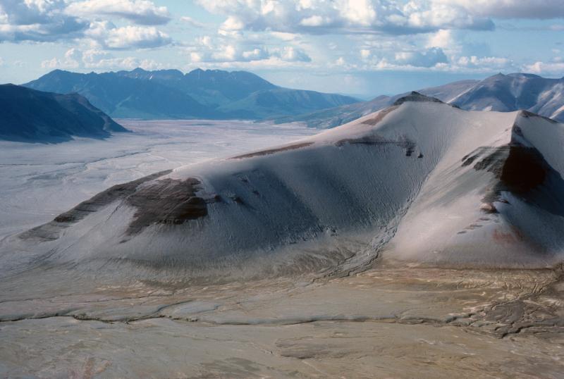


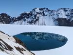


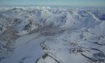

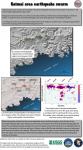

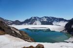


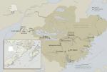


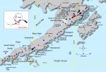


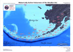


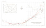


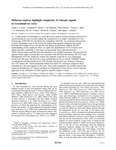
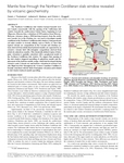
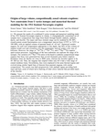


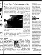


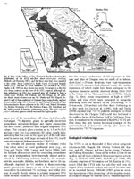


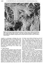
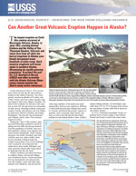


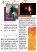


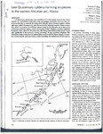
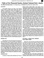


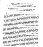


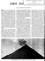
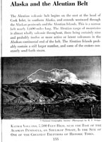
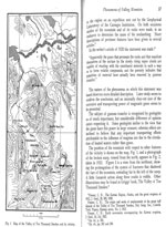

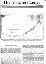


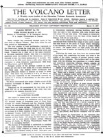


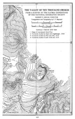
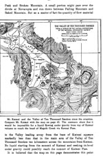


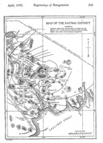
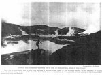


