Moundhill
Spurr
Great Sitkin
Akutan
Aniakchak
Atka volcanic complex
Augustine
Cleveland
Dutton
Edgecumbe
Fisher
Gareloi
Great Sitkin
Griggs
Iliamna
Isanotski
Kanaga
Katmai
Little Sitkin
Mageik
Makushin
Martin
Novarupta
Pavlof
Redoubt
Semisopochnoi
Shishaldin
Snowy
Spurr
Takawangha
Tanaga
Trident
Ugashik-Peulik
Ukinrek Maars
Veniaminof
Westdahl
Wrangell
Adagdak
Addington volcanic field
Alagogshak
Amak
Amchixtam Chaxsxii
Amukta
Andrew Bay volcano
Basalt of Gertrude Creek
Behm Canal-Rudyerd Bay
Black Peak
Blue Mtn
Bobrof
Bogoslof
Buldir
Buzzard Creek
Camille Cone
Capital
Carlisle
Chagulak
Chiginagak
Churchill, Mt
Cone 3110
Cone 3601
Dana
Davidof
Denison
Devils Desk
Double Glacier
Douglas
Drum
Duncan Canal
Emmons Lake Volcanic Center
Espenberg
Folsoms Bluff
Fourpeaked
Frosty
Gas Rocks, the
Gilbert
Gordon
Gosling Cone
Hayes
Herbert
Imuruk Lake Volc Field
Ingakslugwat Hills
Ingenstrem Depression Volcanic Field
Ingrisarak Mtn
Iron Trig cone
Iskut-Unuk River cones
Jarvis
Jumbo Dome
Kagamil
Kaguyak
Kasatochi
Kejulik
Kialagvik
Kiska
Klawasi Group
Knob 1000
Kochilagok Hill
Koniuji
Kookooligit Mountains
Koyuk-Buckland volcanics
Kukak
Kupreanof
Lone basalt
Maclaren River volcanic field
Moffett
Monogenetic QT vents of WWVF
Morzhovoi
Nelson Island
Nunivak Island
Nushkolik Mountain volcanic field
Okmok
Pavlof Sister
Prindle Volcano
Rainbow River cone
Recheshnoi
Roundtop
Sanford
Seguam
Segula
Sergief
Skookum Creek
St. George volcanic field
St. Michael
St. Paul Island
Steller
Stepovak Bay 1
Stepovak Bay 2
Stepovak Bay 3
Stepovak Bay 4
Suemez Island
Table Top Mtn
Tanada Peak
Tanax̂ Angunax̂
Tlevak Strait
Togiak volcanics
Trader Mtn
Uliaga
Ungulungwak Hill-Ingrichuak Hill
Unimak 5270
Unnamed (near Ukinrek Maars)
Vsevidof
Western Cones
Wide Bay cone
Yantarni
Yunaska
Legend
✕
| Red (Warning) | |
| Orange (Watch) | |
| Yellow (Advisory) | |
| Green (Normal) | |
| Uninstrumented | |
| Community | |
| Webcam | |
| Instrument | |
| Earthquake Magnitude | |
|
0
| |
| Earthquake Age | |
| Last 2 Hours | |
| Last 2 Days | |
| Last 1 Week | |
Facts
- Official Name: Moundhill Point
- Seismically Monitored: No
- Color Code:
- Alert Level:
- Elevation: m (0ft)
- Latitude: 52.34382
- Longitude: -172.32585
- Smithsonian VNum:
- Pronunciation:
-
Nearby Towns:
- Atka 80 mi (129 km) SW
- Nikolski 151 mi (242 km) NE
- Adak 185 mi (298 km) SW
- Unalaska 262 mi (422 km) NE
- Akutan 298 mi (479 km) NE
Distance from Anchorage: 1039 mi (1671 km)
Description
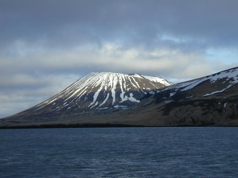
From Jicha and Singer, 2006 [1] : Moundhill is a postglacial monogenetic cone. "Its southeastern flank is built upon 15-20 m of andesitic lavas of unknown age, but the remainder of the cone rises from sea level up to 590 m. The entire cone is composed of numerous 1-3-m-thick, sheet-like, chemically monotonous basalt flows (mvl) distinguished by unusuallylarge (up to 0.7 cm) and abundant plagioclase (40 modal %), clinopyroxene (9%), and olivine (6%) phenocrysts in a glassy matrix. Each flow exhibits pahoehoe structure and extends from near the summit crater all the way to the coast. Levees on several flows descending from the west side of the crater suggest that the inital flow direction was westward, but then shifted to the north or south around the flanks of the stratovolcano. It is possible that the entire cone formed during a single, long-lasting eruption. Several attempts to obtain 40Ar/39Ar ages from Moundhill volcano lavas were unsuccessful due to very low radiogeneic 40AR* yields.Name Origin
The cone at Moundhill Point is informally called "Moundhill." Moundhill Point was named by Lieutenant Commander H.E. Nichols, U.S. Navy, in 1883 (Orth, 1971).
References Cited
[1] Volcanic history and magmatic evolution of Seguam Island, Aleutian island arc, Alaska, 2006
Jicha, B.R., and Singer, B.S., 2006, Volcanic history and magmatic evolution of Seguam Island, Aleutian island arc, Alaska: Geological Society of America Bulletin, v. 118, n. 7-8, p. 805-822.Reported Activity
0 Event Date(s)
Past Activity Legend:
| Eruption | |
| Questionable eruption | |
| Non-eruptive activity |


Showing 1 - 2 of 2
Map Images
Map References
References
Before an eruption
Ashfall & Preparedness Information
- Ashfall impacts & preparedness (US Geological Survey)
- Volcanic health hazards & impacts (International Volcanic Health Hazards Network)
- Ash Alert! Pamphlet (AK Division of Homeland Security & Emergency Management)
- Volcanic Ashfall (AK Department of Environmental Conservation, Division of Air Quality)